Title and statement of responsibility area
Title proper
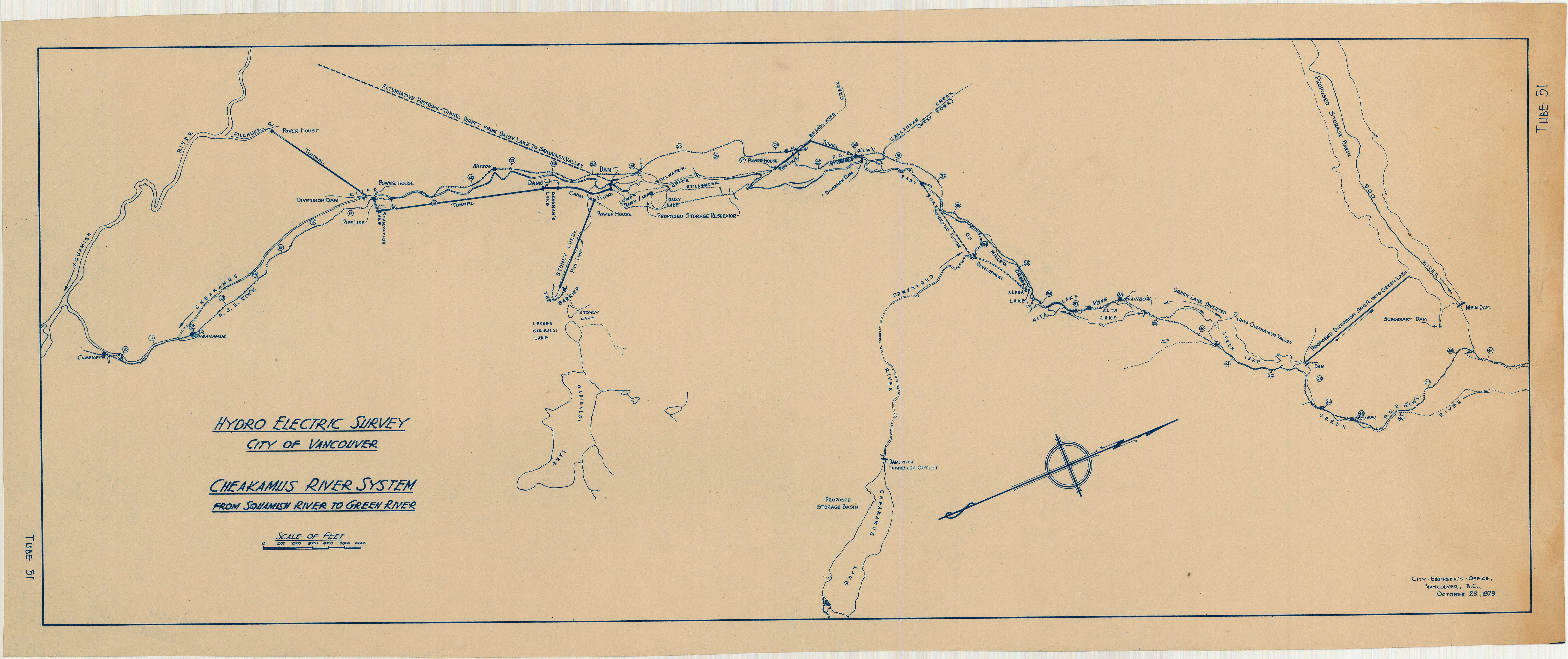
Hydro electric survey City of Vancouver : Cheakamus River system from Squamish River to Green River
General material designation
- Cartographic material
Parallel title
Other title information
Title statements of responsibility
Title notes
Level of description
Item
Reference code
Edition area
Edition statement
Edition statement of responsibility
Class of material specific details area
Statement of scale (cartographic)
Scale [1:36,000]
Statement of projection (cartographic)
Statement of coordinates (cartographic)
Statement of scale (architectural)
Issuing jurisdiction and denomination (philatelic)
Dates of creation area
Date(s)
-
Oct. 23, 1929 (Creation)
Physical description area
Physical description
1 map : positive blueprint on paper ; 34 x 83 cm
Publisher's series area
Title proper of publisher's series
Parallel titles of publisher's series
Other title information of publisher's series
Statement of responsibility relating to publisher's series
Numbering within publisher's series
Note on publisher's series
Archival description area
Name of creator
Custodial history
Scope and content
Item is a map which shows a proposed hydro electric development of the Cheakamus River system from the Squamish River to Green Lake. The map includes proposed tunnel routes, diversions, storage reservoirs, dams, power houses, canals, and pipelines. Also shown are areas of suggested future development and the Pacific Great Eastern railway line. Included in the area surveyed are Garibaldi Lake, Starvation Lake, Deadman's Lake, Daisy Lake, Stoney Lake, Cheakamus Lake, Alta Lake, Nita Lake, Alpha Lake, and Green Lake, as well as the Squamish River, Pilchuk River, Cheakamus River, Soo River, Green River, and various creeks.
Notes area
Physical condition
Immediate source of acquisition
Arrangement
Language of material
Script of material
Location of originals
Availability of other formats
Restrictions on access
Terms governing use, reproduction, and publication
Finding aids
Associated materials
Map 1081.02 is a duplicate map with annotations.
Accruals
Rights
Public domain
External Link
ftp://webftp.vancouver.ca/archives/MAPS-TIFF/MAP1081.01.tif
- Format: TIFF (LZW compressed)
- MD5: CF948989F75BE3BE662518ED43DD7F0A
- Size: 44845672 bytes