Title and statement of responsibility area
Title proper
Hastings Townsite
General material designation
- Cartographic material
Parallel title
Other title information
Title statements of responsibility
Title notes
Level of description
Item
Reference code
AM1594-: MAP 784
Edition area
Edition statement
Edition statement of responsibility
Class of material specific details area
Statement of scale (cartographic)
Scale not defined
Statement of projection (cartographic)
Statement of coordinates (cartographic)
Statement of scale (architectural)
Issuing jurisdiction and denomination (philatelic)
Dates of creation area
Date(s)
-
[ca. 1910]-[ca. 1919] (Creation)
- Note
- Base map published ca. 1910; some annotations refer to 1919 tax sale.
Physical description area
Physical description
1 map on 8 sheets : positive blueprint on linen, annot. ; 103 x 73 or smaller
Publisher's series area
Title proper of publisher's series
Parallel titles of publisher's series
Other title information of publisher's series
Statement of responsibility relating to publisher's series
Numbering within publisher's series
Note on publisher's series
Archival description area
Custodial history
Scope and content
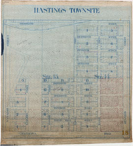
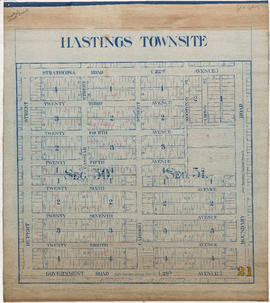
Item is a partial sectional map of Hastings Townsite showing streets, railways, legal addresses, some lot sizes, and municipal boundaries. Item has been annotated with information regarding property ownership, including identification of properties included in a 1919 tax sale, and various symbols of unspecified meaning.
Notes area
Physical condition
Immediate source of acquisition
Arrangement
Language of material
Script of material
Location of originals
Availability of other formats
A digital copy is available.
Restrictions on access
Access to original material is restricted for preservation reasons.
Terms governing use, reproduction, and publication
Finding aids
Associated materials
Accruals
Alpha-numeric designations
Sheets are numbered 1, 9, 14, 15, 18, 19, 20, 21.
Rights
Public domain


