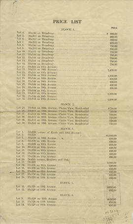
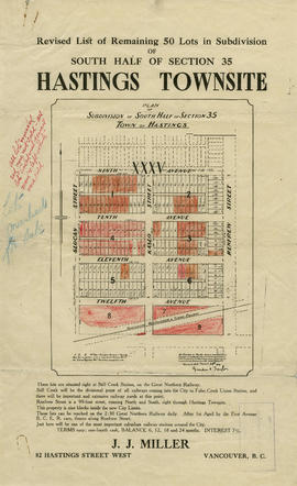
Revised list of remaining 50 lots in subdivision of south half of section 35, Hastings Townsite
- AM1594-: MAP 750
- Item
- [ca. 1909]
Part of City of Vancouver Archives technical and cartographic drawing collection
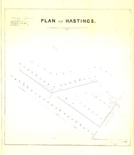
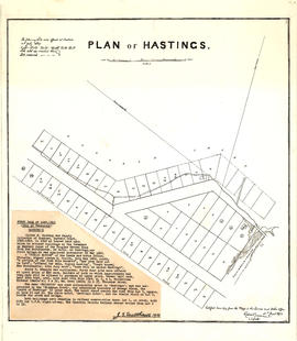
Item contains maps and information regarding lots for sale in the area bounded by Slocan Street, Renfrew Street, 9th Avenue, and 12th Avenue in Hastings Townsite. Sheets include annotations indicating changes in pricing and lots sold.