- COV-S346-F01-: MAP 1074
- Item
- [1923?]
Part of City of Vancouver fonds
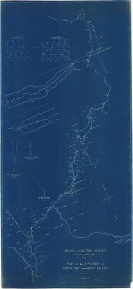
Item is a portion of a topographical map showing Green Lake, the headwaters of the Green River, and the portions of 21 Mile Creek and Fitzsimmons Creek where they empty into Green Lake. The remaining portion of the map shows the Green Lake area from District Lot 2015 to 3336. The map is missing its right-hand portion and title block, though the style and hand are the same as other maps created by the City Engineer's Office as a result of the 1923 surveys of the Squamish, Cheakamus and Green rivers.
The sheet also contains three sections: one of Fitzsimmons Creek at the Pacific Great Easter Railway bridge 40.5, one of the Green River and one of the valley north-west of Green Lake along which the PGE line runs.