- AM738-S1-: MAP 911
- Item
- 1958
Fraser Valley (B.C.)
Taxonomy
Code
Scope note(s)
Source note(s)
Display note(s)
Hierarchical terms
Fraser Valley (B.C.)
Equivalent terms
Fraser Valley (B.C.)
Associated terms
Fraser Valley (B.C.)
130 Archival description results for Fraser Valley (B.C.)
130 results directly related Exclude narrower terms
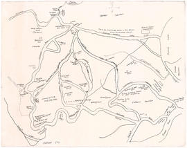
- AM738-S1-: 1980-253.61
- Item
- 1958
Item shows main and local roads, railways, steam and electric lines, post offices, ferry connections, boundary lines, and reservations. Includes index.

Map of New Westminster District, B.C
- AM1594-: MAP 2
- Item
- 1876
Part of City of Vancouver Archives technical and cartographic drawing collection
Item is a map showing District Lots in Vancouver, and township/range designations in other areas. The map also shows False Creek Trail, North Arm Road, False Creek Road, Granville Road from Granville to Hastings, New Westminster and Burrard Inlet Road, North Road, Semiahmoo Road, New Westminster and Yale Wagon Road, and others. Annotated by W. E. Graveley, 1885, to show additional features including Kingsway, Haney, Albion Camp, etc.
City of Chilliwack and surrounding area
- AM738-S1-F6-: 1980-253.41
- Item
- [ca. 1958]
Item shows main highways, roads, railways, power lines, dykes, and contours.
- AM738-S1-F6-: 1980-253.40
- Item
- [ca. 1958]
Item shows main highways, roads, railways, power lines, dykes, and contours.
Municipality of Matsqui [and Municipality of Mission]
- AM738-S1-F6-: 1980-253.39
- Item
- 1958
Item shows main highways, roads, railways, power lines, dykes, and contours.
- AM738-S1-F6-: 1980-253.38
- Item
- [ca. 1958]
Item shows main highways, roads, railways, power lines, dykes, and contours.
Map of Fraser Valley : from Langley to Harrison
- AM738-S1-F6
- File
- [ca. 1958]
File contains four maps that create a larger map of the Fraser Valley.
Road map of the Lower Fraser Valley, eastern portion [left half]
- AM738-S1-F3-: 1980-253.26
- Item
- Jan. 1978
Item is a copy of the road map for the eastern portion of the Lower Fraser Valley used as a worksheet.
Road map of the Lower Fraser Valley, eastern portion [right half]
- AM738-S1-F3-: 1980-253.25
- Item
- Jan. 1978
Item is a copy of the road map for the eastern portion of the Lower Fraser Valley used as a worksheet.
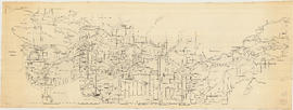
Sectional map and street directory of the Fraser Valley British Columbia
- AM738-S1-: 1980-253.24
- Item
- Jan. 1975
Item is a copy of the Fraser Valley sectional map used as a worksheet.
Road map of the Lower Fraser Valley, eastern portion
- AM738-S1-F3
- File
- Jan. 1978
File contains partial copies of the road map for the eastern portion of the Lower Fraser Valley used as worksheets.
Road map of the Lower Fraser Valley, western portion
- AM738-S1-: 1980-253.12-: 1980-253.12.2
- Part
- Jan. 1977
Road map of the Lower Fraser Valley, eastern portion
- AM738-S1-: 1980-253.12-: 1980-253.12.1
- Part
- Jan. 1977
Fraser Valley, Vancouver to Hope, Centennial Trail
- AM738-S1-: 1980-253.12
- Item
- Jan. 1977
Item consists of a road map of the eastern and western portions of the Lower Fraser Valley, including area details and street indexes.
Road map of the Lower Fraser Valley, western portion
- AM738-S1-: 1980-253.03
- Item
- Mar. 1969
Item shows streets, railways, and sewage dumps, including inset maps of cities and towns.
Road map of the Lower Fraser Valley, eastern portion
- AM738-S1-: 1980-253.02
- Item
- Mar. 1969
Item shows streets, railways, and sewage dumps, including inset maps of cities and towns.

Map of Fraser Valley, British Columbia
- AM738-S1-: MAP 924
- Item
- [ca. 1932]
Item is a map showing trunk roads, main and local roads, and railway lines.
- COV-S346-F01-: MAP 1113
- Item
- [1923?]
Part of City of Vancouver fonds
Map of early Chilliwack district
- AM1594-: MAP 857
- Item
- Jan. 30, 1918
Part of City of Vancouver Archives technical and cartographic drawing collection
Item is a map of the area around Chilliwack and Vedder Mountain showing early family settlements, roads, rivers, churches, stores and other landmarks.
Sepass, William (Billy)

Vancouver : as seen from space : vue de l'espace
- AM1594-: MAP 1187
- Item
- 1986
Part of City of Vancouver Archives technical and cartographic drawing collection
Map shows Vancouver, the Fraser Valley and a portion of the Gulf Islands as seen from space.

Fraser Valley, Surrey & Richmond
- AM1594-: MAP 826-: LEG1800.009
- Part
- 1969
Part of City of Vancouver Archives technical and cartographic drawing collection
Part consists of the front side of a published road map. This side contains road maps of the Fraser Valley, Richmond, and Surrey, as well as street indexes.

Profile Mile 27 to Mile 58 Port Mann Subdivision
- COV-S346-F01-: MAP 1145
- Item
- Aug. 17, 1917
Part of City of Vancouver fonds
Item is a profile of the Canadian Northern Railway right of way through the Fraser Valley.

- AM738-S1-: MAP 925
- Item
- 1932
Item is a map of the Fraser Valley from Vancouver to Chilliwack showing roads, railway lines, schools, churches, and post offices.
Street map of the Fraser Valley
- AM738-S1-: MAP 923
- Item
- [ca. 1945]
Item is a street map of the Lower Mainland and Fraser Valley from Vancouver to Chilliwack.
Subdivision and land use : residential analysis (Fraser Valley, B.C.)
- AM1257-S26-F21-33
- File
- 1957 (revised to 1963)
File contains development analysis report attached to maps.
Residential analysis - Hope, B.C.
- AM1257-S26-F21-32
- File
- 1957 (revised to 1963)
Subdivision and land use : industrial survey (Fraser Valley, B.C.)
- AM1257-S26-F21-31
- File
- 1957 (revised to 1963)
Subdivision and land use : residential analysis (Fraser Valley, B.C.)
- AM1257-S26-F21-30
- File
- 1957 (revised to 1964)
File contains development analysis report attached to maps.
Industrial study : character of the upper Fraser Valley
- AM1257-S26-F21-29
- File
- 1961-1966
Subdivision and land use : industrial survey (Fraser Valley, B.C.)
- AM1257-S26-F21-25
- File
- 1957 (revised to 1964)
Commercial survey (Fraser Valley, B.C.)
- AM1257-S26-F21-24
- File
- 1967
Electric and gas transmission lines rights of way (Fraser Valley, B.C.)
- AM1257-S26-F21-20
- File
- 1961
Geology of the forty-ninth parallel
- AM1257-S26-F21-19
- File
- [196-]
Surficial geology (Chilliwack, B.C.)
- AM1257-S26-F21-18
- File
- 1960
3400 regional series - Lower Mainland (Fraser Valley)
- AM1257-S26-F21-14
- File
- [197-]
Subdivision and land use : industrial survey (Chilliwack, B.C.)
- AM1257-S26-F21-13
- File
- 1957 (revised to 1968)
Subdivision and land use : residential analysis (Chilliwack, B.C.)
- AM1257-S26-F21-10
- File
- 1957 (revised to 1964)
File contains development analysis report attached to maps.
Residential analysis - Cultus Lake
- AM1257-S26-F21-7
- File
- 1957 (revised to 1964)
File contains development analysis report attached to map.
Residential analysis - Matsqui - Abbotsford
- AM1257-S26-F21-6
- File
- 1957 (revised to 1964)
Subdivision and land use : industrial survey (Mission, B.C.)
- AM1257-S26-F21-5
- File
- 1957 (revised to 1966)
Subdivision and land use : residential analysis (Mission, B.C.)
- AM1257-S26-F21-4
- File
- 1957 (revised to 1964)
File contains development analysis report attached to maps
Subdivision and land use : residential analysis (Fraser Valley)
- AM1257-S26-F21-2
- File
- 1957 (revised to 1967)
Subdivision and land use : commercial survey (Maple Ridge, B.C.)
- AM1257-S26-F20-27
- File
- 1957 (revised to 1966)
Subdivision and land use : residential analysis (Pitt Meadows, B.C.)
- AM1257-S26-F20-15
- File
- 1957 (revised to 1965)
Subdivision and land use : industrial survey (Langley, B.C.)
- AM1257-S26-F20-14
- File
- 1957 (revised to 1965)
Subdivision and land use : residential analysis (Pitt Meadows, B.C.)
- AM1257-S26-F20-13
- File
- 1957 (revised to 1964)
Vancouver south (Delta, B.C., Richmond, B.C.)
- AM1257-S26-F20-16
- File
- 1961
New Westminster District (Langley, B.C.)
- AM1257-S26-F20-9
- File
- 1960
Subdivision and land use : residential analysis (Maple Ridge, B.C.)
- AM1257-S26-F20-7
- File
- 1957 (revised to 1964)
Results 1 to 50 of 130