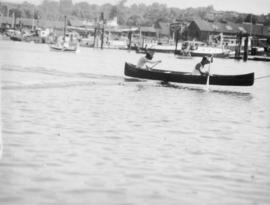
Primary map shows lot numbers and boundaries, streets, fire limits and "soundings in feet" (in English Bay, Burrard Inlet, Coal Harbour and False Creek) in downtown Vancouver, Stanley Park and parts of Kitsilano and Fairview. The ancillary maps show an "Index plan of Vancouver, B.C.", an "Index plan of [Vancouver] city limits" and "Canadian Pacific Mail Steamship Lines" (a map of Canadian Pacifc steamship routes around the world). On recto, the item also includes a description of Stanley Park and an illustration of Vancouver's inner harbour. On verso, the item includes descriptions of major Vancouver residences, imports, exports, businesses and other landmarks.
![[A store and hotel on Coal Harbour]](/uploads/r/null/d/6/d6f7c640b009a7909e9049bcf96331302336a6f4df31089f7e9cd41ef4315050/df20dac6-8ee3-43a7-aab9-9302163b1df7-A33872_142.jpg)


![[Boat] at Gobel Engine Repairs](/uploads/r/null/7/f/6/7f6dbd02bb05231a430491a97bb0b1ff6d277d4161ee326d616e9d1a36d1a42f/43e750fc-b939-4f6e-bd05-3bfd09416f97-CVA288-103_142.jpg)


![Granville [Townsite], B.C. Aug., 1885](/uploads/r/null/1/a/4/1a45ddd637fe3f3726748d5096017a8461446b9a013c408ed2b1666c8433e1f9/405fdc0d-6d88-41b7-937f-36cc7f51518a-MAP553_142.jpg)
![Inauguration dinner [at Trader Vic's], Bea[trice Timmins], Julie and Tom Campbell](/uploads/r/null/9/f/2/9f2983b76c5e8b528211e8c9c419852538a1df157a0d0d165f224dfec5952c52/eab1465c-3840-4e29-b689-8c794a97ee7a-CVA289-273_142.jpg)
![Inauguration dinner [at Trader Vic's], Mayor and Mrs. [Rathie], B.I. and Adams](/uploads/r/null/2/d/f/2dfef1f7ae1791006f47140caede9b77742abd54416201425e24faf3403599b8/c558544c-6316-4867-b04a-3e431a375281-CVA289-276_142.jpg)
![Inauguration dinner [at Trader Vic's], Mayor [Rathie] and Mrs. Gould](/uploads/r/null/b/4/c/b4c46a3260386255b76ebe217e31bb38704b226fe64025af77671949dda65a2e/8a25cf3d-ed34-4e77-838b-7ef9876de601-CVA289-275_142.jpg)
![Inauguration dinner [at Trader Vic's], Mr. and Mrs. Gould [and] R. Baker](/uploads/r/null/8/1/d/81d6c017cf2e152544ca6219e0172d9ca0ef3e8ddd3e6fb3ecbe7ea884f384cc/e6d4b09f-cd15-41e9-a180-05d678c09b3c-CVA289-274_142.jpg)
![Inauguration dinner [at Trader Vic's], Ron Thompson talking](/uploads/r/null/6/d/3/6d3d1a2500824823fb1d635c929e9fcb0ad13521b963e9dc8507f59b4cf47c2c/ff2c1aff-6cfe-4923-93f5-f20f08fac9ec-CVA289-280_142.jpg)
![Inauguration dinner [at Trader Vic's], Ron [Thompson], Russ B., Williams, Emery, Alsbury](/uploads/r/null/1/f/a/1fa59d4eff4964b2a81dd0f6110b4c241eb0e9a2f44991efa308c2555352ad5f/a5d8d479-bab1-4f23-9a51-4c410cdd8a38-CVA289-279_142.jpg)
![Inauguration dinner [at Trader Vic's], south end of table, Bell-Irving and Gould](/uploads/r/null/9/a/5/9a5d96b7e0800af6b3b5420ff91c61db2abb859fe753a86180f7d8503d88804d/d8e27bc2-f267-4158-bedc-a1b18558fac2-CVA289-278_142.jpg)
![Inauguration dinner [at Trader Vic's], Williams talking](/uploads/r/null/0/2/7/027438181e696241e2ec7bc82d48e27259ac452d6cb37f92d2068a8d51829201/fffc99e2-660d-4428-ba1c-8614c9d1a70d-CVA289-282_142.jpg)
![Inauguration dinner [at Trader Vic's], Wilson talking](/uploads/r/null/6/9/e/69ef720523584eb049fc7faf7d87522ff55f5335053a93e4d1fbaea26b24c99e/0f51d900-1cb2-4449-a86a-f306c81a0a6e-CVA289-281_142.jpg)


![Inauguration lunch at Trader Vic's, head table [with] J.D. Wilson and Rev. Gorwill](/uploads/r/null/e/5/6/e56e4506ac46ff6df1a578b32c87b2751dfca8971e07b01955c7f06a63e4ab56/c12d5a40-f7c1-41bf-a09c-8201365218ff-CVA289-191_142.jpg)
![Inauguration lunch at Trader Vic's, Marianne [Linnell] getting the bananas [from Mayor Rathie]](/uploads/r/null/2/1/4/2149f4ca46ca1d456137d2119f10347f1b436c30df69ff7892cc0574c8d8cfca/d09ad59c-5e3d-49bc-bdfa-ae223b6ef898-CVA289-193_142.jpg)