
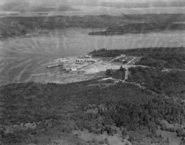
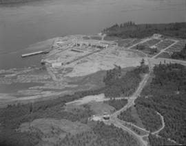
Tyee Spit Camp : Campbell River
- AM1545-S3-: CVA 586-15398
- Item
- 1952
1100 results directly related Exclude narrower terms
Tyee Spit Camp : Campbell River

Tyee Spit Camp : Campbell River

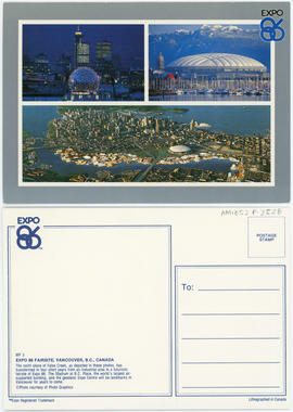
Expo 86, Vancouver, B.C., Canada
Item is a postcard showing a photograph of the Expo Centre dome. Caption on back of photograph: "The fairsite's most dramatic piece of architecture, Expo Centre as viewed from the air."

Expo 86 Fairsite, Vancouver, B.C., Canada
Item is a postcard showing an aerial photograph of Vancouver featuring the Expo 86 site. Caption on back of postcard: "Located on the north shore of False Creek, the site of Expo 86 is truly magnificent. Covering over 165 acres and featuring over 80 participants, the world is coming to British Columbia in 1986."
Expo 86 Fairsite, Vancouver, B.C., Canada
Item is a postcard showing three images of the Expo 86 site. Caption on back of postcard: "The north shore of False Creek, as depicted in these photos, has transformed in four short years from an industrial area to a futuristic fairsite of Expo 86. The Stadium at B.C. Place, the world's largest air-supported building, and the geodesic Expo Centre will be landmarks in Vancouver for years to come."

Item is a postcard showing an aerial view of Vancouver, the Burrard Inlet and the North Shore Mountains. Caption on back of postcard: "Aerial view of the downtown core, English Bay and beautiful Kitsilano. The Planetarium, Burrard and Granville Street Bridges shown in the foreground. A background of the beautiful North Shore mountains and one of the world's largest ice-free deep water harbours."

Vancouver, B.C., Canada : aerial view of downtown Vancouver, Burrard Inlet and North Shore Mountains
Item is a postcard showing an aerial view of Vancouver, the Burrard Inlet and the North Shore Mountains. Caption on back of postcard: "The harbours are ice free throughout the year accommodating the world's largest ships of all nations. Considered to be one of the most beautiful cities in the world with ideal recreation facilities in close proximity to the city centre."

Item is a postcard showing an image of an aerial view of Downtown Vancouver, the Burrard Inlet and the North Shore Mountains. Caption on back of photograph: "This aerial view showing Granville Street Bridge in the foreground is a clear testimonial to the exciting skyline and surrounding beauty of this seaport city. The residential areas of West and North Vancouver are seen in the background."

Aeroplane view of Vancouver, B.C., Canada : Royal Canadian Air Force photograph
Campbell River town site : aerial, rollie, streets

Campbell River town site : aerial, rollie, streets

Aerial : school at airport, Sea Island

Aerial : school at airport, Sea Island
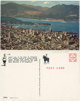
Aerial view of the heart of Vancouver, B.C., Canada
Item is a postcard showing an aerial view of Vancouver. Caption on back of postcard: "Aerial view of the heart of Vancouver, B.C., Canada, showing its modern skyline, harbor, Burrard Inlet and Stanley Park with North and West Vancouver and the North Shore Mountains in the background."

Vancouver, B.C., Canada : West End and park - looking west to Point Atkinson
Item is a postcard showing an aerial view of the West End and Stanley Park. Caption on back of postcard: "Aerial view showing the Burrard Inlet; part of Downtown Vancouver; Stanley Park; the Lions Gate Bridge; West Vancouver and the North Shore Mountains."
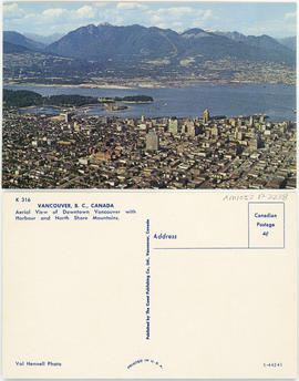
Vancouver, B.C., Canada : Aerial view of Downtown Vancouver with harbour and North Shore Mountains
![[Aerial view of] Gibsons and Ganthams Landing](/uploads/r/null/1/b/1b41e2b231d73b916b0afd6c0aa24761139a2ac2a334315a5346df931974b1e8/74ad7138-f2e9-41d1-bf1a-485b390ae6d6-A31839_142.jpg)
[Aerial view of] Gibsons and Ganthams Landing
Part of Major Matthews collection
Oblique view
![[Aerial view looking east of downtown Vancouver and the waterfront]](/uploads/r/null/a/1/a146c28159c45997dd3312d8a94967907da12e5b5c1139902f95665ab0e54675/740905a3-6e61-4ffc-bc08-d90ad82bc7d8-A67011_142.jpg)
[Aerial view looking east of downtown Vancouver and the waterfront]
Part of Major Matthews collection
Oblique view shows the Immigration buildings, C.P.R. Piers A, B and C, the Courthouse, Hotel Vancouver, Marine building and Vancouver block.
![[H.M.C.S. "Vancouver"]](/uploads/r/null/4/0/40d05283991f8a914e2f61116a8aa8fdd34edba558afb1cedac93df18b745017/22fe1139-eab9-4358-ac03-5356b4e12a8a-A67012_142.jpg)
Part of Major Matthews collection


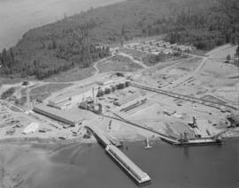
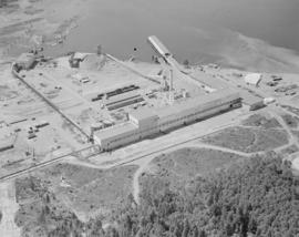
Aerials : Elk Falls Mill : Duncan Bay

Aerials : Elk Falls Mill : Duncan Bay

Aerials : Elk Falls Mill : Duncan Bay

Aerials : Elk Falls Mill : Duncan Bay

Aerials : Elk Falls Mill : Duncan Bay
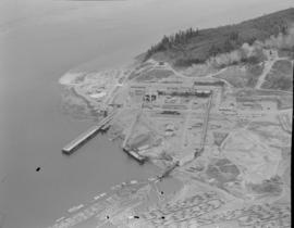
Aerials : Elk Falls Mill : Duncan Bay

Aerials : Elk Falls Mill : Duncan Bay

Aerials : Elk Falls Mill : Duncan Bay

Aerials : Elk Falls Mill : Duncan Bay

Elk Falls Co. : Campbell River aerials
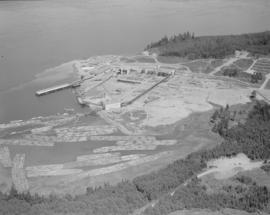
Elk Falls Co. : Campbell River aerials

Elk Falls Co. : Campbell River aerials
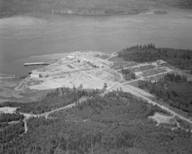
Elk Falls Co. : Campbell River aerials

Elk Falls Co. : Campbell River aerials
Elk Falls Co. : Campbell River aerials
Elk Falls Co. : Campbell River aerials
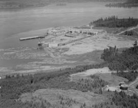
Elk Falls Co. : Campbell River aerials
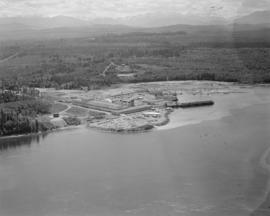
Elk Falls Co. : Campbell River aerials

Elk Falls Co. : Campbell River aerials
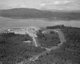
Elk Falls Co. : Campbell River aerials

Elk Falls Co. : Campbell River aerials

Elk Falls Co. : Campbell River aerials
Elk Falls Co. : Campbell River aerials
![[Aerial view of Vancouver and Burnaby]](/uploads/r/null/f/b/fbdba44a19d2b4928094d872a6a16513550380c67160420213fe19581531e9c6/bb3aa326-0dd0-4dbe-879c-2a4a1527d49f-A66597_142.jpg)
[Aerial view of Vancouver and Burnaby]
Part of Major Matthews collection
Photograph shows Vancouver Technical School, Grandview Highway and Renfrew Playing Fields.
![[Aerial view of Mount Pleasant, South Strathcona and Kensington-Cedar Cottage]](/uploads/r/null/7/5/75ea991fe8319eaffda79b314cbf20e281e35eb2cd8a89eaa898b492242d6282/05f856f3-0a45-41eb-94dc-46cb9d2f7ecf-A63348_142.jpg)
[Aerial view of Mount Pleasant, South Strathcona and Kensington-Cedar Cottage]
Part of Major Matthews collection
Photograph shows aerial view of the east end of False Creek, Thornton Park, Great Northern Railway and Canadian National Railway yards, Mount Pleasant, Strathcona, Grandview-Woodland, Trout Lake, Kingsway, Vancouver Technical School grounds, Renfrew playing fields, John Hendry Park, British Columbia Electric Railway Right of Way, Clark Park, Grandview Highway South, Great Northern Railway.
![[Aerial view of Vancouver]](/uploads/r/null/b/9/b973b9a4143a5316b02e728c35d99e383f27a3db21d8e20aa7bbb459780243bc/3ff38b56-6b36-4c17-bce1-329c97459d29-A66598_142.jpg)
Part of Major Matthews collection
Photograph shows Kitsilano, Kits Point, Kitsilano Beach, R.C.A.F. Equipment Depot, Kitsilano Pool, Burrard Bridge, C.P.R. Kitsilano Trestle, Granville Island, Granville Bridge, Cambie Bridge, False Creek, C.P.R. False Creek Yards, West End, Yaletown, Arbutus Ridge, Shaughnessy, South Cambie, Fairview, Mount Pleasant, Little Mountain Reservoir, Connaught Park, Quilchena Golf Course, Douglas Park, Shaughnessy Heights Golf Course, Queen Elizabeth Park, Royal Canadian Mounted Police Barracks, Shaughnessy Military Hospital, Hillcrest Park, Robertson & Hacket Sawmill, City Yard, West Coast Ship Builders and Athletic Park.