![Boundary [Road] and Schow [intersection, 1 of 4]](/uploads/r/null/9/d/e/9de504013f062deedb17bb01bb59afdd66410ac1d6421740ad2a0c3cc6e29f38/a5ff20f5-8d1a-49f8-9bcd-d74c95538908-2019-103.0710_142.jpg)
Boundary [Road] and Schow [intersection, 1 of 4]
- COV-S505-1-: 2019-103.0710
- Item
- 1982
Part of City of Vancouver fonds
732 results directly related Exclude narrower terms
Boundary [Road] and Schow [intersection, 1 of 4]
Part of City of Vancouver fonds
![Boundary [Road] and Schow [intersection, 2 of 4]](/uploads/r/null/6/e/7/6e7b2091c53bf7b54f83769174f80ba2c9d31bb7809d626da1fa941db92733f7/768331de-dc5a-4f9c-aeb8-d8712eeac4ee-2019-103.0711_142.jpg)
Boundary [Road] and Schow [intersection, 2 of 4]
Part of City of Vancouver fonds
![Boundary [Road] and Schow [intersection, 3 of 4]](/uploads/r/null/3/e/4/3e46e101effe703e0618eb0ba4b56c6238acfe509551055da9fc3aa480eccadd/f40084de-0dc4-49ab-85ca-31a3c1d02eed-2019-103.0712_142.jpg)
Boundary [Road] and Schow [intersection, 3 of 4]
Part of City of Vancouver fonds
![Boundary [Road] and Schow [intersection, 4 of 4]](/uploads/r/null/2/d/1/2d1d1ff9f09e3224970127b9c7b74dc4e559dabc4b2a942afca72b4e7ae80904/120952a0-0d33-4308-8d38-11d102d4658b-2019-103.0713_142.jpg)
Boundary [Road] and Schow [intersection, 4 of 4]
Part of City of Vancouver fonds
![Boundary [Road] and Schow [traffic controller]](/uploads/r/null/a/6/6/a666926cbd8c18a09bcb55ce0ad37f40ddc05f7700cc713dd3f9be542b325817/4e700b03-72f4-41fb-acf0-a2c6df11a0ae-2019-103.0714_142.jpg)
Boundary [Road] and Schow [traffic controller]
Part of City of Vancouver fonds
![Boundary [Road] and Superial [intersection, 1 of 4]](/uploads/r/null/2/f/0/2f008ab64e1ef8a7366004ba0346fee8d0768b1153242d8af2e9e324140824ae/99c8a02c-17b6-4abd-9430-5c42113be8b0-2019-103.0705_142.jpg)
Boundary [Road] and Superial [intersection, 1 of 4]
Part of City of Vancouver fonds
![Boundary [Road] and Superial [intersection, 2 of 4]](/uploads/r/null/e/3/2/e3235a0caa4953812559ad5cf0c0684d1ece77e3eab0c1c9aa180a75f73327c2/1f296166-0e9e-427d-85dd-95715ff95fcb-2019-103.0706_142.jpg)
Boundary [Road] and Superial [intersection, 2 of 4]
Part of City of Vancouver fonds
![Boundary [Road] and Superial [intersection, 3 of 4]](/uploads/r/null/f/6/c/f6c37cd5d08b8d9ea6d46f4a38fc4eccec3a648dc121a076fa1cefdb7927f7e3/033cc02d-2b99-4055-be1b-05eee3f1e618-2019-103.0707_142.jpg)
Boundary [Road] and Superial [intersection, 3 of 4]
Part of City of Vancouver fonds
![Boundary [Road] and Superial [intersection, 4 of 4]](/uploads/r/null/c/f/6/cf65dfa637f5f2177a8ae2f98bb4ee3ad4106281b9025fd52f476d7aba0bfab1/6c0716fa-f88a-4de5-b700-63bec54ce4a6-2019-103.0708_142.jpg)
Boundary [Road] and Superial [intersection, 4 of 4]
Part of City of Vancouver fonds
![Boundary [Road] and Superial [traffic controller]](/uploads/r/null/f/e/6/fe686e0702a826a7fbc1bd0ac0e346ed95490e503e20fef928c0c6b37087a0f0/70d6082b-6a5e-4423-a1aa-db22102bc056-2019-103.0709_142.jpg)
Boundary [Road] and Superial [traffic controller]
Part of City of Vancouver fonds

Part of Major Matthews collection
Photograph shows a woman with an umbrella on Park Road
!["Brunette Butts" [Royal Engineer's Range, East Road]](/uploads/r/null/6/b/6bc8c5c95838d6dfbb521e7895a3a9b75a1bae5d7f4baa07467ddea0dba6b252/be9a9536-7dbe-48d3-a4ea-903058d17e05-A59735_142.jpg)
"Brunette Butts" [Royal Engineer's Range, East Road]
Part of Major Matthews collection
!["Brunette Butts" [Royal Engineer's Range, East Road]](/uploads/r/null/5/a/5a4d77dd21e5c2daa97679d032520a55bcc664bed8fc56ed0cbfdc6cbaa77812/1f8b84ab-e1c0-46df-a63a-113456e9fb49-A59736_142.jpg)
"Brunette Butts" [Royal Engineer's Range, East Road]
Part of Major Matthews collection
![[Buildings along a road in Gibsons]](/uploads/r/null/9/b/9bcd325cd596e134475ef3e39f1c8955a684862e29f1047317792b7bb31a6f73/714e0511-d1a0-4764-ae17-049a9f23c280-A33784_142.jpg)
[Buildings along a road in Gibsons]
Part of Major Matthews collection
Canadian Traffic Signal Corporation - Photo of New Signals on Benwicke Avenue
Part of Stuart Thomson fonds
![[Capilano Creek and the road leading to the old dam]](/uploads/r/null/b/e/be01881a66b0c78930e0ce748d6dde5951f2d2e3959ea751f043c90820689850/3d504293-6333-4630-898a-426f1cbe8651-A34035_142.jpg)
[Capilano Creek and the road leading to the old dam]
Part of Major Matthews collection
Photograph shows The Lions in the background

Car on Malahat Drive, Vancouver Island, B.C.

Part of Major Matthews collection
![Cassiar [Street] and [Highway] 401 [1 of 7]](/uploads/r/null/3/8/e/38e4471827dbc3a8089440b36e727e996da29493e84a6bb7ffd2515b3a77c58b/df736d89-549d-4088-a8f1-fb239337aeb0-2019-103.0537_142.jpg)
Cassiar [Street] and [Highway] 401 [1 of 7]
Part of City of Vancouver fonds
![Cassiar [Street] and [Highway] 401 [2 of 7]](/uploads/r/null/c/d/1/cd1981c43327730d06a2535223fa9ee65078252c9a858cac28892dba5edd722e/fff423a8-cae9-4698-9cbe-2f68577aeae9-2019-103.0538_142.jpg)
Cassiar [Street] and [Highway] 401 [2 of 7]
Part of City of Vancouver fonds
![Cassiar [Street] and [Highway] 401 [3 of 7]](/uploads/r/null/6/5/9/6597641edc353946d6f7c3d8bb4fef779568944b08b8257bdd559dd15f0fa732/ad6b3c4f-fead-49c1-9038-6239ccda4c53-2019-103.0539_142.jpg)
Cassiar [Street] and [Highway] 401 [3 of 7]
Part of City of Vancouver fonds
![Cassiar [Street] and [Highway] 401 [4 of 7]](/uploads/r/null/3/8/d/38d7115bff9526ca7c5034b8abeef664f039dcd1d443cf38520ddbde19c2a61e/6efb9cd8-9b85-4ad5-9c1c-0016ed26f58f-2019-103.0540_142.jpg)
Cassiar [Street] and [Highway] 401 [4 of 7]
Part of City of Vancouver fonds
![Cassiar [Street] and [Highway] 401 [5 of 7]](/uploads/r/null/d/5/5/d55876baf2e7963f7c2d7bedaeae7d4f60e336bf135546b3da810e838ad4920b/1c7fcca8-470f-42ee-92a9-c65a29c13f38-2019-103.0541_142.jpg)
Cassiar [Street] and [Highway] 401 [5 of 7]
Part of City of Vancouver fonds
![Cassiar [Street] and [Highway] 401 [6 of 7]](/uploads/r/null/6/6/4/664aebde0315f35e71fb097baade0c62fa0ba0d617bb0e55630516246968b1d8/787deb01-437b-4559-9400-78e8ba41e769-2019-103.0542_142.jpg)
Cassiar [Street] and [Highway] 401 [6 of 7]
Part of City of Vancouver fonds
![Cassiar [Street] and [Highway] 401 [7 of 7]](/uploads/r/null/0/c/3/0c36bc5f20d000f972c86cf44a03cf730019ed5e8b1c0aa91ee570034357b05f/9fa596b1-f31d-495c-919a-6cd2188362fe-2019-103.0543_142.jpg)
Cassiar [Street] and [Highway] 401 [7 of 7]
Part of City of Vancouver fonds
![Cassiar [Street] and [Highway] 401 DJC 30' from stop line](/uploads/r/null/9/1/a/91a37ada72d613d5f067f8ecbdaa6881ef10c1d96453cd75802d5e535ac9f513/aca369b4-904f-4cbd-a5c3-bf5b224df724-2019-103.0546_142.jpg)
Cassiar [Street] and [Highway] 401 DJC 30' from stop line
Part of City of Vancouver fonds
![Cassiar [Street] and [Highway] 401 [traffic controller]](/uploads/r/null/4/6/9/469dcf2fddea0312fd3f788ed73366e24d06a1811dc47cc04ba5c20cbb3e58cf/67056f52-de7d-4999-90e7-293906bbc487-2019-103.0544_142.jpg)
Cassiar [Street] and [Highway] 401 [traffic controller]
Part of City of Vancouver fonds
![Cassiar [Street] and [Highway] 401 [traffic controller]](/uploads/r/null/b/d/0/bd0e2388f24d27e28dec07806e6440b83687233a38ac5ad89c0cbfd6303d5053/9bd4321e-024d-4b29-86b1-321ed762a7fe-2019-103.0545_142.jpg)
Cassiar [Street] and [Highway] 401 [traffic controller]
Part of City of Vancouver fonds
![Castle M[oun]t[ain] near Banff](/uploads/r/null/6/3/c/63cd2862638d414f4c978e0dcfeb457ea1c84268825751fa0f28a34917807bec/774e6de5-4b9b-4e33-8576-c927715658cb-CVA289-004_142.jpg)
Castle M[oun]t[ain] near Banff
Part of William Orson Banfield fonds

Cathedral Grove, Vancouver Island
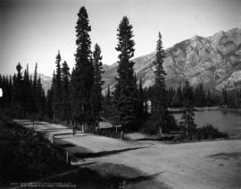
Cave and Basin Drive, Banff, Alta.
Part of Richard H. Trueman fonds
Photo shows sign for Bow River House Boats.
![China Bar Bluff - 28 miles above Yale on the Frazer [Fraser] River](/uploads/r/null/e/9/e9834f1ddcca28563493687bbfecb9567f9ba986b5c202f487df6365406543dc/a92c2367-8f8d-4de3-bbe6-978a47016230-A22918_142.jpg)
China Bar Bluff - 28 miles above Yale on the Frazer [Fraser] River
Part of Major Matthews collection
Photograph shows the cribbing supports for the "Waggon" [wagon] Road

Chinese market, looking west at the 200 block Keefer Street
Part of McGuigan family fonds
City of Vancouver British Columbia
Part of City of Vancouver Archives technical and cartographic drawing collection
The map is a positive blueprint of the City of Vancouver with boundaries, streets block numbers & the harbour headline. A detailed compass appears in the top left corner of the map. The legend is also in the top left hand corner depicting City boundaries, Harbour headlines, Postal Blocks, and street numbers. There is a copy of the Map included, Map 71B, and it includes the Geographic Census Tracts.
The westernmost identifiable point on the map is the Straight of Georgia, and the easternmost is Boundary Road. The northernmost point on the map is the Stanley Park, the southernmost is Sea Island and Twiggs Island.

Part of Major Matthews collection
![[Clay Hill on River Road (Marine Drive)]](/uploads/r/null/4/b/4bbe92a0f4b0e5e0d64ec9f07da76cccf5ee0220c80af0c140353fb09ccbaf31/dffea40d-29e4-4a6a-a7c8-0c661570ade3-A37098_142.jpg)
[Clay Hill on River Road (Marine Drive)]
Part of Major Matthews collection
Clay Hill, River, now Marine Drive
Part of Dunbar History Project fonds
Item filed under Transportation. Photographed by Miss M.E. McCleery near her father's farm. Courtesy of the City of Vancouver Archives.
![[Clearing the road after the Seymour Creek washout]](/uploads/r/null/f/c/fc6cfe672265e867d583e925ffa6c0fd3a92c7305bcba121a6f71a099afd83a8/56561df4-6b84-4fc0-b5c1-6523edbfeb84-A33580_142.jpg)
[Clearing the road after the Seymour Creek washout]
Part of Major Matthews collection
![[Clearing the road after the Seymour Creek washout]](/uploads/r/null/9/9/99242e16650f1431f325e9bb60c86ba094a887a37b72eeded67645bde3379e12/ce8d67eb-7f17-43dd-9625-f5b95c1c1b2d-A33576_142.jpg)
[Clearing the road after the Seymour Creek washout]
Part of Major Matthews collection
Photograph shows F.L. Fellowes
![[Clearing the road after the Seymour Creek washout]](/uploads/r/null/1/e/1ebe2d6f26e96a26ae0360f58ff42655dc2845782a4d16f4c7b5cb8d33146801/4c35ed37-348f-40ff-b97f-a63d9d9360dd-A33569_142.jpg)
[Clearing the road after the Seymour Creek washout]
Part of Major Matthews collection
![[Clearing the road after the Seymour Creek washout]](/uploads/r/null/3/5/358ec572746441d60d555a7b7babb4ca18786ae34ac812377045d3a3d70e3016/6ba322a6-c3e9-4474-a5b9-944593cdf228-A33579_142.jpg)
[Clearing the road after the Seymour Creek washout]
Part of Major Matthews collection
Photograph shows F.L. Fellowes and others


Columbia Avenue, Rossland, B.C.
Photograph shows buildings under construction
Commercial Map of Greater Vancouver and District [BC]
Part of City of Vancouver Archives technical and cartographic drawing collection
Commercial map of Greater Vancouver and District depicts railroads, paved streets, streetcar stops, schools, buildings. Uniquely, the map shows the city divided by Postal Block numbers and half mile circles that radiate from City Hall on the corner of Main and Hastings.
The map has large red arrows and clippings of libraries pasted to it that show six proposed library locations and sketch plans. Also included on the map, is an index of all depicted roads in the Hastings, Point Grey, South Vancouver, and Burnaby areas. A legend and compass rose are located in the bottom left hand corner of the map.
The westernmost is road on the map is Marine Drive and the easternmost is North Road while the northernmost is Dempsey Street, and the southernmost is 20th Road.
Commercial Map of Greater Vancouver and District [BC]
Part of City of Vancouver Archives technical and cartographic drawing collection
The map shows the Greater Vancouver Area and its roads, streets, and residential, commercial, and industrial districts in July 1924. In accordance with the legend, the map shows railroads, electric railways, parks, and buildings. The map uniquely depicts the center of Vancouver which is approximately 5400 feet and spans from Water and Railway Street to Prior Street and Abbott Street to Princess Street. The center circle then concentrically expands outwards with other circles marking every mile outward.
Additionally, there are annotations in black, red, yellow, and green. The black annotations mark topography and contour lines with listed elevations. The red annotations mark water gauges. The yellow annotations indicate the best routes through the City and District as suggested by the Automobile Club of BC. The green annotations appear for an unknown reason.
The Westernmost road on the map is Marine Drive and the Easternmost is Columbia Street and North Road while the Northernmost road on the map is Dempsey St. in North Vancouver and the Southernmost point is No. 20 Road.
Commercial Map of Greater Vancouver and District [BC]
Part of City of Vancouver Archives technical and cartographic drawing collection
The map shows the Greater Vancouver district, Point Grey, West Vancouver, North Vancouver, South Vancouver, and Burnaby - in 1886. In correspondence, the legend and map display railroads, paved streets, schools, and buildings. Uniquely, the map shows the city divided by Postal Block numbers and half mile circles that radiate from City Hall on the corner of Main and Hastings. The Westernmost road on the map is Marine Drive and the easternmost is Columbia Street. Northernmost road on the map is Dempsey Street, and the Southernmost point is No. 20 Road.
A detailed compass, in the bottom left hand corner of the map, shows Magnetic North. The annotation M.49 appears in the bottom right hand corner and the top left hand corner of the map. Two copies of the map are available, one a blue line the other a linen copy.
![Compliments of the Season [Road in Stanley Park]](/uploads/r/null/4/1/4106d634b52f60ab182dd91c03bf0d9e9bdb133e8c0350259f047f1372b65c5b/510fb0a7-a16f-4ed6-b7c7-e61f1d25ace8-A21428_142.jpg)
Compliments of the Season [Road in Stanley Park]
Part of Walter E. Frost fonds

Corner Pipe Line and Fromme Road, Lynn Valley, B.C.
Photograph shows intersection of two roads, and surrounding trees and stumps. Photograph also shows a signpost indicating the corner of Fromme and Lynn Valley Roads.

Part of James Crookall fonds

Country road with farm house, Ayr
Part of James Crookall fonds