Title and statement of responsibility area
Title proper
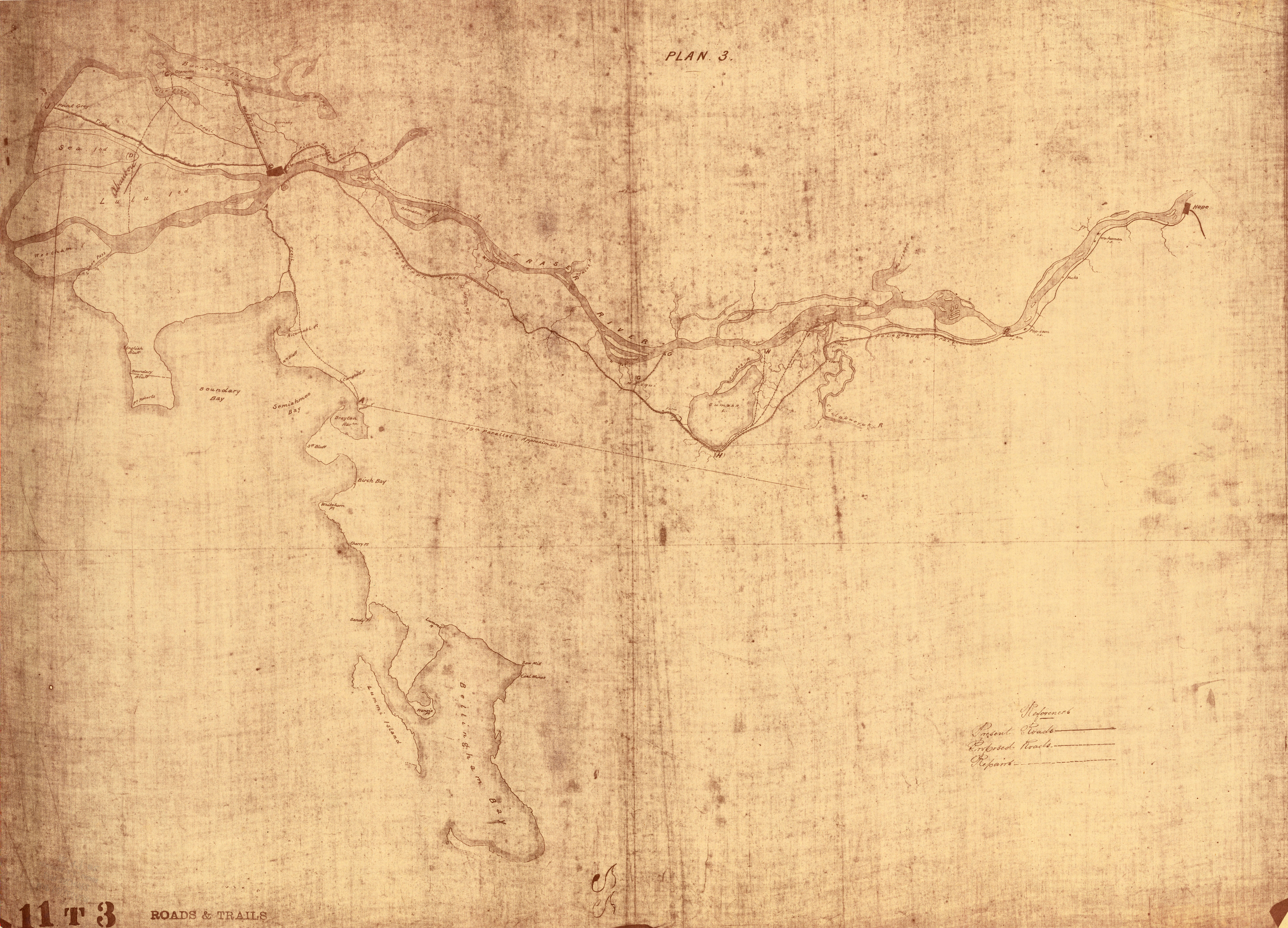
Plan 3
General material designation
- Cartographic material
Parallel title
Other title information
Title statements of responsibility
[drawn by Joseph Hunter?]
Title notes
Level of description
Item
Reference code
Edition area
Edition statement
Edition statement of responsibility
Class of material specific details area
Statement of scale (cartographic)
Scale indeterminable
Statement of projection (cartographic)
Statement of coordinates (cartographic)
Statement of scale (architectural)
Issuing jurisdiction and denomination (philatelic)
Dates of creation area
Date(s)
Physical description area
Physical description
1 map : diazo ; 69 x 94 cm
Publisher's series area
Title proper of publisher's series
Parallel titles of publisher's series
Other title information of publisher's series
Statement of responsibility relating to publisher's series
Numbering within publisher's series
Note on publisher's series
Archival description area
Custodial history
Scope and content
Map shows present and proposed roads of the Lower Mainland and northern Washington State, as well as road repairs. Map covers the area from Point Grey to Hope and from Burrard Inlet to Bellingham Bay. Trails and roads indicated on the map include Telegraph Trail, Waggon Road and Pitt River Waggon Road, as well as several unnamed trails. Major bodies of water indicated on the map are Burrard Inlet, False Creek, Burnaby Lake, Pitt River, Fraser River, Sumas Lake, Sumas River, Chulukweyuk River, Harrison River, Boundary Bay, Semiahmoo Bay and Bellingham Bay. Place names are indicated throughout the map. 11T3 Roads & Trails is printed on the side of the map.
Notes area
Physical condition
Image is quite faint.
Copy made from a blueprint.
Immediate source of acquisition
Arrangement
Language of material
Script of material
Location of originals
Availability of other formats
Use microfiche copy in Reading Room.
Restrictions on access
Terms governing use, reproduction, and publication
Finding aids
Associated materials
The first sheet of this map is numbered MAP 97.01.
Accruals
General note
The initials "CS" have been drawn on the map.
General note
Map formerly located at 205-A
External Link
ftp://webftp.vancouver.ca/archives/MAPS-TIFF/MAP97.02.tif
Format: TIFF (LZW compressed)
MD5: 49357FD4AD50C86E8BBF8D23AE86A8D4
*Size: 100466744 bytes
Alternative identifier(s)
Standard number area
Standard number
Access points
Place access points
Name access points
- Hunter, Joseph (Publisher)