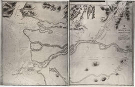
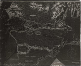
Title and statement of responsibility area
Title proper
Maps, plans, and other historical documents
General material designation
- Graphic material
Parallel title
Other title information
Title statements of responsibility
Title notes
- Source of title proper: Title based on contents of series
Level of description
Series
Reference code
AM54-S13
Edition area
Edition statement
Edition statement of responsibility
Class of material specific details area
Statement of scale (cartographic)
Statement of projection (cartographic)
Statement of coordinates (cartographic)
Statement of scale (architectural)
Issuing jurisdiction and denomination (philatelic)
Dates of creation area
Date(s)
-
[18--]-1959 (Creation)
Physical description area
Physical description
14 cm of cartographic materials and other material
Publisher's series area
Title proper of publisher's series
Parallel titles of publisher's series
Other title information of publisher's series
Statement of responsibility relating to publisher's series
Numbering within publisher's series
Note on publisher's series
Archival description area
Name of creator
(1878-1970)
Custodial history
Scope and content
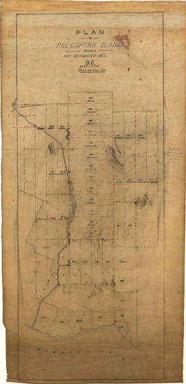
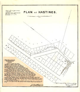
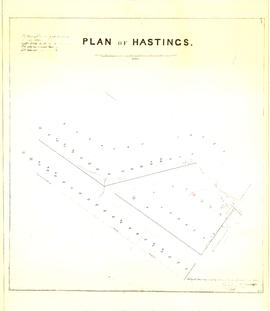
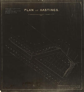
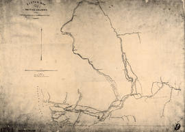
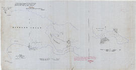
Series consists of records which are of some historical significance and which are grouped together because of their physical size. Includes maps, plans, drawings, correspondence, newspaper articles, photographs, genealogical documents, and a baptismal register.
Notes area
Physical condition
Immediate source of acquisition
Arrangement
Language of material
Script of material
Location of originals
Availability of other formats
Restrictions on access
Terms governing use, reproduction, and publication
Finding aids
Item list available







![Plan of Vancouver, 1889 [fire map] : reproduction information](/uploads/r/null/f/d/0/fd037a042d459e848e2551c388330163a9024c34fbb369a24eb67982c5f0648e/3846775d-2909-437d-8096-d72f41dc728a-LEG1319_142.jpg)
![Plan of Vancouver, 1889 [fire map] : key](/uploads/r/null/2/d/d/2dd00e0e5f9f81455303a65e65cd8a72826a3a90f5776da19eced51a0e94a70e/57c1716f-e8b5-480f-b0d6-10bc34c26e4d-LEG1319_142.jpg)
![Plan of Vancouver, 1889 [fire map] : key plan](/uploads/r/null/8/c/6/8c665d9b7be5e0a033f9fa314887d042b58ffa86dd66700f591f0a361e8494e6/5fe0b006-5a84-4d22-b351-18327132cb6a-LEG1319_142.jpg)
![Plan of Vancouver, 1889 [fire map] : special index and street index](/uploads/r/null/a/0/d/a0d6a0e785fe9ae5e3616b856b263f8ba4dfdc71d0a4f3ea1cbf4cd9258e911d/e529b13c-5866-420d-9eb7-10b837d46d05-LEG1319_142.jpg)
![Plan of Vancouver, 1889 [fire map] : [Burrard Inlet to Burrard Street to Pender Street to Granvil...](/uploads/r/null/d/9/8/d9875fcb8389ab25ccfe4f64a026e775f3c062e456ad02af2d3fb7aa9e9418f1/b301955e-8a05-4e4b-bc17-91ec66e60295-LEG1319_142.jpg)
![Plan of Vancouver, 1889 [fire map] : [Burrard Inlet to Granville Street to Pender Street to Homer...](/uploads/r/null/0/c/8/0c8a16a0695c15d69b586737c4a131b5583e8bdfbfbc2c67f973db550b0829cf/1bcc9ddd-5ddf-470d-b142-7af1f38429bd-LEG1319_142.jpg)
![Plan of Vancouver, 1889 [fire map] : [Water Street to Homer Street to Dupont Street to Abbott Str...](/uploads/r/null/9/5/3/953e385e7ca0e16135884c35ec202ac962e22e67120a4631717dbddfaad0a991/1fa01249-de13-4f3d-a35e-6a248d7cebd0-LEG1319_142.jpg)
![Plan of Vancouver, 1889 [fire map] : [Water Street to Abbott Street to Dupont Street to Carrall S...](/uploads/r/null/6/6/3/6638767bd68cebbf3372d365653e0235a420d9c36939c000e044aac9a9af0355/c3b76952-9335-4c2b-8cea-4842e8da82a9-LEG1319_142.jpg)
![Plan of Vancouver, 1889 [fire map] : [Westminster Avenue to Hastings Street to Carrall Street to ...](/uploads/r/null/4/6/e/46e5907e8c0ee11cc72c511f0e91da0f36951eb27490657505e1e0b085b95b6d/ab4cb491-e5ce-47c8-baa2-9b158b9ae486-LEG1319_142.jpg)
![Plan of Vancouver, 1889 [fire map] : [Pender Street to Seymour Street to Georgia Street to Hamilt...](/uploads/r/null/9/e/b/9eb4d4d998b8f0bcd10cad57409c4720a54130a7d99c135975d3664a60ff1679/6dcc473e-f6b5-4027-a18d-9ba2e154d57c-LEG1319_142.jpg)
![Plan of Vancouver, 1889 [fire map] : [Pender Street to Hornby Street to Georgia Street to Seymour...](/uploads/r/null/1/3/3/1335f5ab7611a13de713a19dee6a47e0090f19a9c0f8d929f11fb14bafb50d72/82c4eaad-4be6-4caa-84f3-d7cb0462694e-LEG1319_142.jpg)
![Plan of Vancouver, 1889 [fire map] : [Georgia Street to Howe Street to Smythe Street to Richards ...](/uploads/r/null/b/5/7/b5795979d3e757fe65b0cd171489f207866fcb2912605cbf26067a415d6e6331/06ad084f-c642-4236-a798-f15a4e53fae0-LEG1319_142.jpg)
![Plan of Vancouver, 1889 [fire map] : [Seaton Street to Thurlow Street to Georgia Street to Hornby...](/uploads/r/null/c/0/5/c05c9007f65179fd3dbb7f8aaa24a062a6ef240f434c1e9c83801f4da7cde42b/0de62d75-0658-4dfd-a336-606e14aaba38-LEG1319_142.jpg)
![Plan of Vancouver, 1889 [fire map] : [Burrard Street to Georgia Street to Bute Street to Robson S...](/uploads/r/null/5/1/d/51dc2aa61cbf795f25c7072a0c7654a3c3582cee803489422a41ee35a797f577/dd9a68d4-2c61-47a1-a8ef-9b5472b8d710-LEG1319_142.jpg)
![Plan of Vancouver, 1889 [fire map] : [Westminster Avenue to Alexander Street to Carrall Street to...](/uploads/r/null/6/2/9/629e1af59ab802dbae0ca70e4ad1bc21d892d20e0a02831593379ef33ab619ab/ea98e61d-ab11-4f17-9d63-494139f1565e-LEG1319_142.jpg)
![Plan of Vancouver, 1889 [fire map] : [Railway Street to Westminster Avenue to Hastings Street to ...](/uploads/r/null/b/a/4/ba4e0e34c72219c070af0aca2b15d3d22118b6afcbc4d683958c3ff02350040b/15bf9b04-b823-4216-92f3-5135cc6766a8-LEG1319_142.jpg)
![Plan of Vancouver, 1889 [fire map] : [Hastings Saw Mill to Dunlevy Avenue]](/uploads/r/null/3/9/a/39aab88ee80638f7f4470ffb63daa53aebd58cfc3e949cc2a48f8153a37f4e73/be5e00fe-eb22-4bc7-ae25-6bef3ca82fc2-LEG1319_142.jpg)
![Plan of Vancouver, 1889 [fire map] : [Railway Street to Dunlevy Avenue to Hastings Street to Carl...](/uploads/r/null/6/a/7/6a7427d6b45f34a7b50447d4e5d106c0acdb8fb395d43f72380b4e3377220398/43aa1c69-bbd8-4b48-9189-a18bd64afa77-LEG1319_142.jpg)
![Plan of Vancouver, 1889 [fire map] : [Burrard Inlet to Carl Avenue to Hastings Street to Hawks Av...](/uploads/r/null/e/2/3/e23da9d90d7cd49bb8afc1dd228b693a8d4bdda054fc281e530e501a0727848b/914577ba-487a-40ea-b1ac-8a70368a9ef0-LEG1319_142.jpg)
![Plan of Vancouver, 1889 [fire map] : [Hastings Street to Westminster Avenue to Harris Street to D...](/uploads/r/null/7/3/e/73e32f78be81f42aa2ed95b18d96b662690eefd72efa22734b37c7c4440689de/fb2612c5-708a-46f0-b9d4-262c519b41a4-LEG1319_142.jpg)
![Plan of Vancouver, 1889 [fire map] : [Gore Avenue to Harris Street to False Creek to Prior Street]](/uploads/r/null/9/e/7/9e77b94299e73d69f036ed4658c1fe0121f96328ec7fac7aecd64cff707dbe6c/7b98af77-89af-47a9-95f8-1f7f8a2d880b-LEG1319_142.jpg)
![Plan of Vancouver, 1889 [fire map] : [Prior Street at Westminster Avenue]](/uploads/r/null/8/f/c/8fc66c2e89bd509d063179aa81af96aab4796167611fab0bd513e5312e3faf76/4699b3cc-c6f5-4b9e-9d53-ac1cfd547a84-LEG1319_142.jpg)
![Plan of Vancouver, 1889 [fire map] : [Jackson Avenue to Hastings Street to Dunlevy Avenue to Harr...](/uploads/r/null/9/c/b/9cb058b5430f742ff9092ead32136b0710bf8a256df4d7d8bfe9601ff02a7b7e/81fe310f-19a1-4237-8495-fbb492fa5bcb-LEG1319_142.jpg)
![Plan of Vancouver, 1889 [fire map] : Royal City Planning mills, G. Cassidy and Co. mill, and Mood...](/uploads/r/null/6/2/2/6226783ea833dec77c0394ee1250c281833804702d4e6875f184384b3ccd55a0/db3c6131-9b0c-4d30-ab06-968914250de8-LEG1319_142.jpg)


