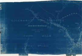
Land subdivision

Taxonomy

Code

Scope note(s)

Source note(s)

Display note(s)

Hierarchical terms

Land subdivision

Equivalent terms

Land subdivision

Associated terms

Land subdivision

289 Archival description results for Land subdivision

289 results directly related Exclude narrower terms

British Columbia : Port Moody sheet : west of seventh, east and west of coast meridians

Item is a map of the Lower Mainland of British Columbia, from the international border in the south to Britannia Beach in the north and from Sechelt Peninsula in the west to Chilliwack and Harrison Lake in the east. Map shows railways, railway stations, trails, roads surveyed, post offices, townships, and ranges.

British Columbia federal constituencies

Item is a map sheet with two maps and data regarding federal constituencies in British Columbia. The principal map shows the boundaries of the constituencies. The secondary map is a detail map showing the boundaries in constituencies in Greater Vancouver. The constituency data includes the number of voters in each constituency, the number of votes cast in the 1940 election, and each candidate's name.

British Columbia. Port Moody

Item is a map showing subdivisions of townships in Coquitlam, Port Moody, Pitt Meadows, Surrey, Langley, Sumas, Sardis and Chilliwack. The west coast of British Columbia from Burrard Inlet to the Sechelt peninsula is shown as well as Vancouver Island and the surrounding Gulf Islands. Trails, post offices and railway stations are included.

Brochure regarding sales of provincial government property in Vancouver

Item is a brochure advertising the sale of land in Vancouver owned by the provincial government. One side of the unfolded brochure is promotional text and an index map showing the general location of the lands to be sold. The reverse of the sheet shows a portion of District Lot 192 and the lots available for sale.

Canadian Pacific Railway. Plan of part of branch line from Port Moody. A point on main line C.P.R. to English Bay, B.C.

Map shows a survey conducted by the Canadian Pacific Railway of English Bay, Burrard Inlet and Coal Harbour, including a rough outline of area and lots. Note on map reads "Certified as a correct plan showing the land required for right of way Burrard Inlet B.C., February 22, 1886. H.J. Cambie, Engineer in Charge." Map is certified as correct and signed by various C.P.R. officials, including W.C. Van Horne.

City of Vancouver : Canadian Pacific town site

Part contains four maps. The main map shows district lots and block numbers in Vancouver from Vine Street in the west to Boundary Avenue (Glen Drive) in the east and Stanley Park in the north to 9th Avenue (Broadway) in the south. Three smaller maps include an index plan to district lots in Vancouver, South Vancouver, New Westminster, and Burnaby; a world map showing Canadian Pacific mail steamship lines; and an index plan of Vancouver city limits. Part has been annotated with text describing a June 1888 land clearance plan and hand colouring indicating clearance status.

City of Vancouver : Canadian Pacific town site

Item is a map showing lot numbers and street names in Vancouver's West End from Boundary Avenue (now Glen Drive) in the east to Chilco Street in the west and Kitsilano (from First Avenue in the north to Fifth Avenue in the south and from Heather Street in the east to Vine Street in the west). The three inset maps are a map of "Canadian Pacific mail steamship lines" around the world, an "Index plan of Vancouver, B.C." and an "Index plan city limits".

City of Vancouver : Canadian Pacific town site

Primary map shows lot numbers and boundaries, streets, fire limits and "soundings in feet" (in English Bay, Burrard Inlet, Coal Harbour and False Creek) in downtown Vancouver, Stanley Park and parts of Kitsilano and Fairview. The ancillary maps show an "Index plan of Vancouver, B.C.", an "Index plan of [Vancouver] city limits" and "Canadian Pacific Mail Steamship Lines" (a map of Canadian Pacifc steamship routes around the world). On recto, the item also includes a description of Stanley Park and an illustration of Vancouver's inner harbour. On verso, the item includes descriptions of major Vancouver residences, imports, exports, businesses and other landmarks.

City of Vancouver : Canadian Pacific town site

Part contains four maps. The main map shows district lots and block numbers in Vancouver from Vine Street in the west to Boundary Avenue (Glen Drive) in the east and Stanley Park in the north to 9th Avenue (Broadway) in the south. Three smaller maps include an index plan to district lots in Vancouver, South Vancouver, New Westminster, and Burnaby; a world map showing Canadian Pacific mail steamship lines; and an index plan of Vancouver city limits.

City of Vancouver : Residential lots, Area B, Champlain Heights

Item contains information on the sale of lots in Champlain Heights by the City of Vancouver. A map shows lot numbers, lot sizes, lot values and sidewalk crossings in the area from Rosemont Drive in the north to 63rd Avenue in the south and from Butler Street in the east to Kerr Street in the west, and text outlines the details associated with sales.

City-owned lands-False Creek

Item is a map showing the location of City-owned properties around the perimeter of the western half of False Creek, west of the Connaught Bridge (Cambie Street Bridge) as of Nov. 1969. City-owned lots are outlined in coloured pencil. Notations are also included on land usage, ownership and land transfers os some south shore properties not owned by the City.

Annotations have been made on a part of a copy of a base map originally created to show land transfers between the C.P.R and the Government of British Columbia.

Vancouver (B.C.). Properties Division

Greater Vancouver

Map shows boundaries, lot numbers and major roads in Greater Vancouver (including West Vancouver, North Vancouver, the City of North Vancouver, the City of Vancouver, Coquitlam, Point Grey, South Vancouver, Burnaby, New Westminster, Port Moody, Port Coquitlam, Pitt Meadows, Surrey, Langley, Delta and Richmond).

Hastings Townsite

Item is a partial sectional map of Hastings Townsite showing streets, railways, legal addresses, some lot sizes, and municipal boundaries. Item has been annotated with information regarding property ownership, including identification of properties included in a 1919 tax sale, and various symbols of unspecified meaning.

Hastings Townsite : Nanaimo Street to Renfrew Street and 13th Avenue to Strathcona Road (22nd Avenue)

Part is a sheet of a sectional map of Hastings Townsite showing streets, railways, legal addresses, some lot sizes, and municipal boundaries. Item has been annotated with information regarding property ownership, including identification of properties included in a 1919 tax sale, and various symbols of unspecified meaning.

Hastings Townsite : Nanaimo Street to Renfrew Street and Burrard Inlet to Cambridge Street

Part is a sheet of a sectional map of Hastings Townsite showing streets, railways, legal addresses, some lot sizes, and municipal boundaries. Item has been annotated with information regarding property ownership and various symbols of unspecified meaning.

Hastings Townsite : Nanaimo Street to Renfrew Street and Strathcona Road (22nd Avenue) to Government Road (29th Avenue)

Part is a sheet of a sectional map of Hastings Townsite showing streets, railways, legal addresses, some lot sizes, and municipal boundaries. Item has been annotated with information regarding property ownership and various symbols of unspecified meaning.

Hastings Townsite : Renfrew Street to Rupert Street and 5th Avenue to 13th Avenue

Part is a sheet of a sectional map of Hastings Townsite showing streets, railways, legal addresses, some lot sizes, and municipal boundaries. Item has been annotated with information regarding property ownership, including identification of properties included in a 1919 tax sale, and various symbols of unspecified meaning.

Hastings Townsite : Renfrew Street to Rupert Street and Strathcona Road (22nd Avenue) to Government Road (29th Avenue)

Part is a sheet of a sectional map of Hastings Townsite showing streets, railways, legal addresses, some lot sizes, and municipal boundaries. Item has been annotated with information regarding property ownership and various symbols of unspecified meaning.

Hastings Townsite : Rupert Street to Boundary Road and 5th Avenue to 13th Avenue

Part is a sheet of a sectional map of Hastings Townsite showing streets, railways, legal addresses, some lot sizes, and municipal boundaries. Item has been annotated with information regarding property ownership, including identification of properties included in a 1919 tax sale, and various symbols of unspecified meaning.

Hastings Townsite : Rupert Street to Boundary Road and Strathcona Road (22nd Avenue) to Government Road (29th Avenue)

Part is a sheet of a sectional map of Hastings Townsite showing streets, railways, legal addresses, some lot sizes, and municipal boundaries. Item has been annotated with information regarding property ownership and various symbols of unspecified meaning.

Indexed guide map of the city of Vancouver and suburbs

Part is a map showing district lots, blocks, and boundaries between the City of Vancouver, Point Grey, South Vancouver, Burnaby, New Westminster, and parts of Richmond, North Vancouver and West Vancouver. Concentric circles indicate the distance in miles from the intersection of Main Street and Hastings Street in intervals of 1/2 mile.

Lillooet District from sale April 6th 1911

Item is a copy of a the left-hand portion of a land registry map showing part of the Lillooet Land District. The portion shows part of the upper Lillooet River and surrounding area. The original map has multiple annotations re: land sales.

Lot numbers, boundaries, railway lines and street names in the municipality of Point Grey

Primary map shows lot numbers, boundaries, railway lines and street names in the municipality of Point Grey from 16th Avenue in the north to the Fraser River in the south and from Ontario Street in the east to Blanca Drive in the west. A smaller map in the bottom left-hand corner of the item shows the north west portion of Point Grey.

Map of City of Vancouver

Item is a map showing land streets and land subdivision in the "old" city of Vancouver. An index map shows the location of Vancouver within the Lower Mainland. Annotations include notes on possible dating in J.S. Matthews' hand.

Results 1 to 50 of 289