- PUB-: PD 2112
- Item
- 1989
Part of City publications collection
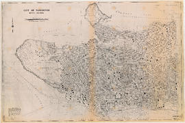
Item is a map showing streets, address block numbers, parks, schools, golf courses, First Nations reserves, railways, and topographic contour lines.
269 results with digital objects Show results with digital objects
Part of City publications collection
Item is a map showing streets, address block numbers, parks, schools, golf courses, First Nations reserves, railways, and topographic contour lines.

Part of City publications collection

Part of City publications collection

Part of City publications collection

Part of City publications collection

Part of City publications collection

Part of City publications collection

Part of City publications collection

Part of City publications collection

City of Vancouver, B.C. area map : Inverness Street to Boundary Road and 32nd Avenue to 54th Avenue
Part of City publications collection

City of Vancouver, B.C. area map : Maple Street to Heatley Avenue and Burrard Inlet to 6th Avenue
Part of City publications collection

Part of City publications collection

Part of City publications collection
Item is a brochure promoting bicycle use in Vancouver, with a map of bicycle routes on one side and safety information on the other.

Part of City publications collection
Part contains safety and security information for cyclists and a small map of major bikeways in Vancouver.

Part of City publications collection
Part contains safety and security information for cyclists and a small map of major bikeways in Vancouver.

One way streets : Illustrated map of Downtown Vancouver
Part of City publications collection
Part contains an illustrated map of Downtown Vancouver showing traffic flow along new one-way streets. Illustration has been annotated with address block numbers and continuations of streets directly east of Main Street.

One way streets : illustrations of special intersections
Part of City publications collection
Part contains pamphlet cover and illustrations showing traffic flow at the intersections of Robson Street and Cambie Street, Richards Street, Water Street, and Cordova Street, and Beatty Street and Pender Street
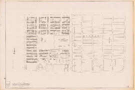
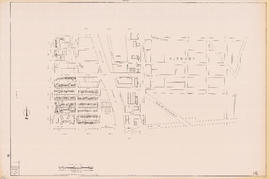
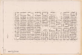
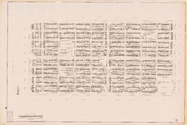
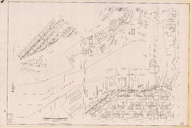
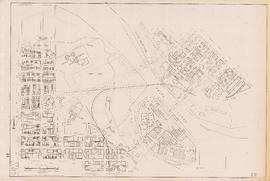
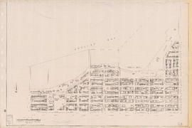
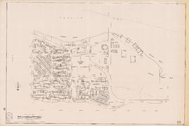
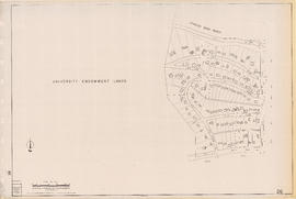
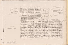
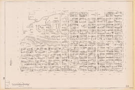
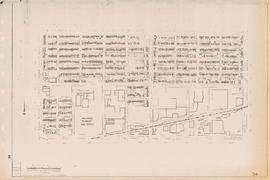
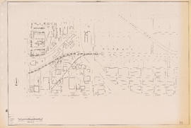
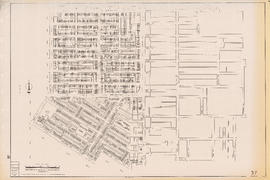
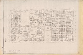
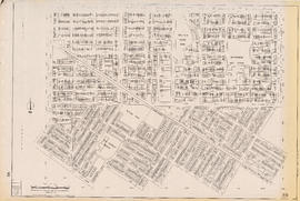
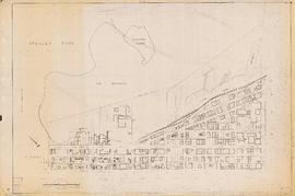
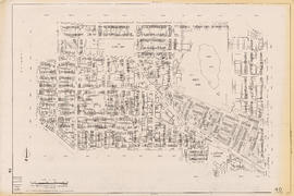
Sectional map of Vancouver showing streets, block and lot outlines, and building perimeters
Part of City publications collection
Item is a sectional map of Vancouver showing streets, block and lot outlines, address block numbers, building perimeters, and street codes according to street codes according to a system adopted by the Engineering Department in the mid-1960s. Building perimeters are not shown on Maps 46, 58-70, 74-75, 78-82, and 90.


Part of City publications collection


Part of City publications collection

Part of City publications collection
Part of City publications collection
Part of City publications collection
Part of City publications collection
Part of City publications collection


Part of City publications collection
Part of City publications collection
Part of City publications collection

Part of City publications collection
Part of City publications collection
Part of City publications collection
Part of City publications collection

Part of City publications collection

Part of City publications collection

Part of City publications collection

Part of City publications collection
Part of City publications collection
Part of City publications collection

Part of City publications collection
Part of City publications collection
Part of City publications collection
Part of City publications collection
Part of City publications collection