
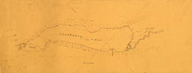


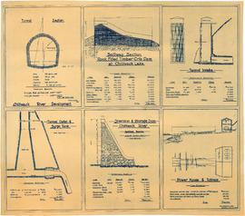


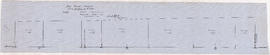


![Longitudinal section along [centre line] of dam sites at north end of Green Lake](/uploads/r/null/7/4/a/74af74789da62d7da66c012dd18dd964e4e83151ac5f0b139a53843bce6ccfe6/974ff05f-0f29-4e65-b818-c663b1a236e1-MAP1142_142.jpg)
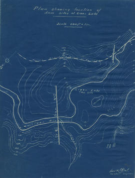
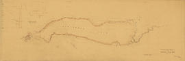

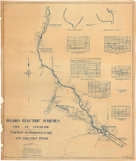
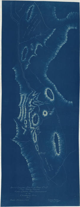
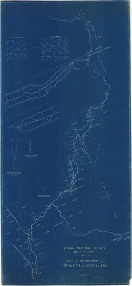
![General plan [of hydro-electric development on Green River]](/uploads/r/null/d/9/e/d9e4c58e28a2189f0c1819b9c491a0478fad0353e2100858ec1eb94c55b96eae/93fa8e5f-c3b7-4e51-802d-979b7bc07f6f-MAP1098_142.jpg)
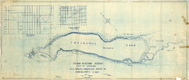
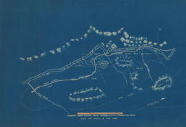
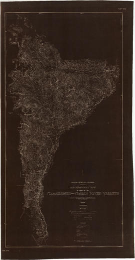
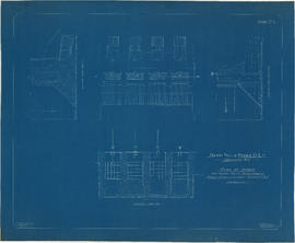
![Plan of fore bay [Nairn Falls hydro electric development]](/uploads/r/null/a/5/5/a55f94fc41cdf02e4a01434daeaf4b6c8715d61bd2a3842a95887e8c7f3371d0/29aba9ea-44a6-4453-9451-4896c8923762-MAP1099_142.jpg)


Title and statement of responsibility area
Title proper
Hydro-electric investigation maps, survey drawings, and measurement data
General material designation
- Textual record
- Cartographic material
- Photograph
- Architectural drawing
Parallel title
Other title information
Title statements of responsibility
Title notes
Level of description
Series
Reference code
Edition area
Edition statement
Edition statement of responsibility
Class of material specific details area
Statement of scale (cartographic)
Scales vary
Statement of projection (cartographic)
Statement of coordinates (cartographic)
Statement of scale (architectural)
Scales vary.
Issuing jurisdiction and denomination (philatelic)
Dates of creation area
Date(s)
Physical description area
Physical description
0.02 m of textual records and other materials
Publisher's series area
Title proper of publisher's series
Parallel titles of publisher's series
Other title information of publisher's series
Statement of responsibility relating to publisher's series
Numbering within publisher's series
Note on publisher's series
Archival description area
Name of creator
Administrative history
The creation of the position of City Engineer was required by bylaw #1. In addition to their other responsibilities, early City Engineers advised the Board of Works with what projects were necessary and presented them with recommendations on tenders. The Engineer also supervised an assistant engineer who carried out surveys, a street inspector, and the city’s scavengers who performed refuse collection.
The Office of the City Engineer received and sent correspondence on behalf of his divisions for certain matters (particularly in the early years, when the “City Engineer” and “Engineering Department” were nearly synonymous), produced manuals, reports, and publications; and otherwise contained documents which were directed to or emanated from the position of City Engineer proper.
From time to time, the City Engineer would be involved with special committees, such as the Metric Conversion Committee from 1977-1979.
The following individuals have served as City Engineer (from 1995, the City Engineer was also referred to as “General Manager” of the then renamed Engineering Services):
• John P. Lawson, 1886-1890;
• Henry B. Warren, 1890-1891;
• Thomas H. Tracy, 1891-1905;
• William A. Clement, 1905-1911;
• Frederick L. Fellowes, 1911-1924;
• Charles Brakenridge, 1924-1946;
• Charles A. Battershill, 1946-1949;
• John C. Oliver, 1949-1956;
• Randolph M. Martin, 1956-1971;
• Gordon H. Lawson, 1971-1974;
• William H. Curtis, 1974-1991;
• David Rudberg, 1991-[2004]
• Tom Timm, [2004]-2010
• Peter Judd, 2010 -
Custodial history
Scope and content
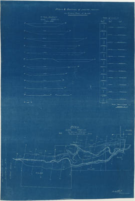
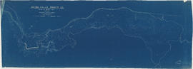
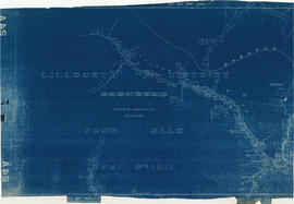
Series documents efforts by the City Engineer's Office to plan hydro-electric development to serve the City of Vancouver, and is related to hydro-electric surveys conducted in the first three decades of the 20th century in the areas to the north, north-east and south-east of Greater Vancouver. The series consists of maps and survey drawings prepared for City-commissioned reports by the City Engineer's office, as well as reference maps and other proposals by firms such as the B.C. Electric and Power Company, the Bridge River Power Company, or the Nairn Falls Power Company, produced and compiled during report preparation on the source of hydro-electric power for Vancouver.
Notes area
Physical condition
Immediate source of acquisition
Arrangement
Language of material
Script of material
Location of originals
Availability of other formats
Restrictions on access
Terms governing use, reproduction, and publication
Finding aids
Associated materials
Accruals
Physical description
Series also contains 101 maps, 5 architectural drawings and two photographs.