Title and statement of responsibility area
Title proper
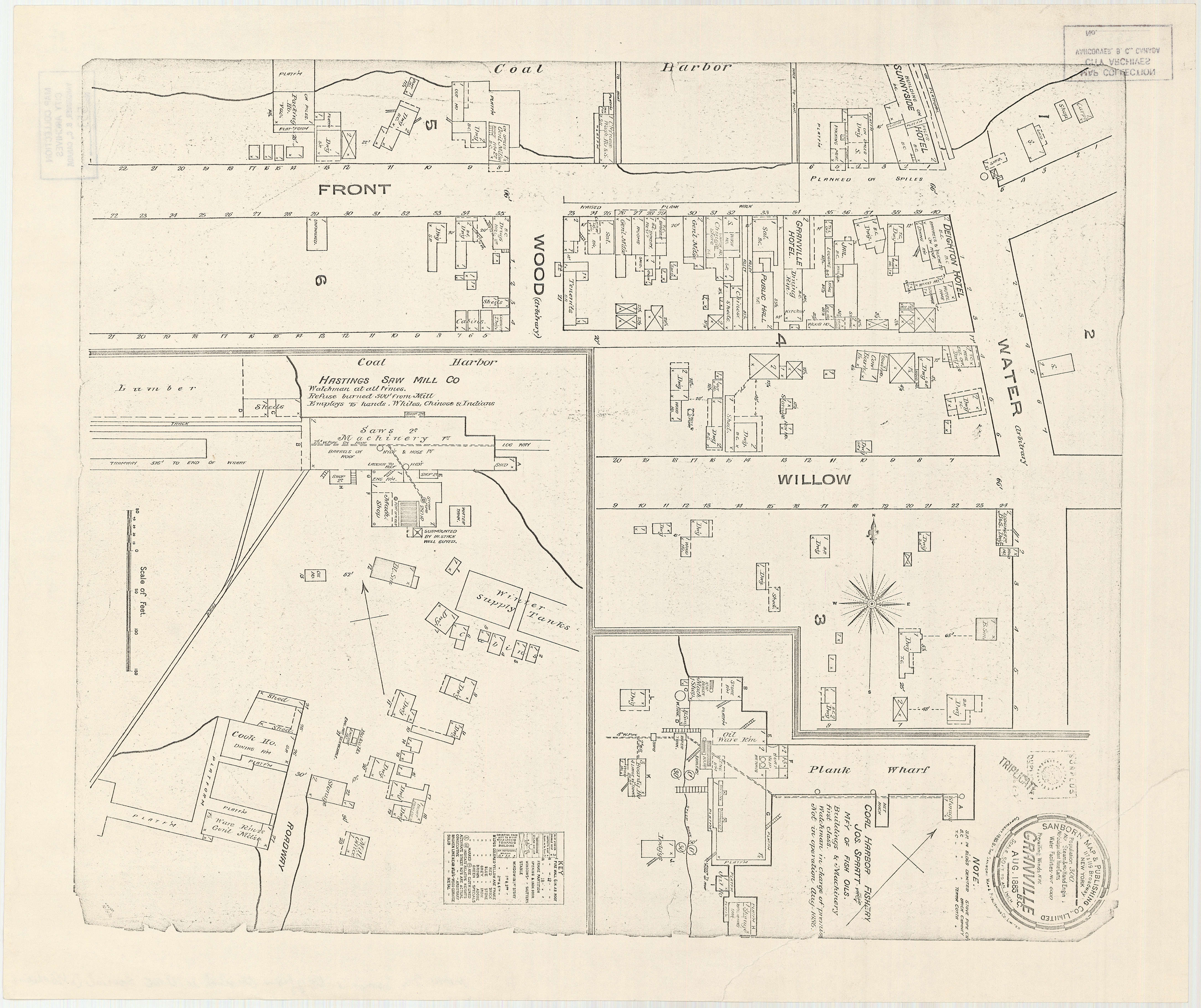
Granville [Townsite], B.C. Aug., 1885
General material designation
- Cartographic material
Parallel title
Other title information
Title statements of responsibility
Title notes
Level of description
Item
Reference code
AM1594-: MAP 553
Edition area
Edition statement
Edition statement of responsibility
Class of material specific details area
Statement of scale (cartographic)
Scale [1:800]
Statement of projection (cartographic)
Statement of coordinates (cartographic)
Statement of scale (architectural)
Issuing jurisdiction and denomination (philatelic)
Dates of creation area
Date(s)
Physical description area
Physical description
1 map : photo-mechanical reproduction ; 54 x 46 cm
Publisher's series area
Title proper of publisher's series
Parallel titles of publisher's series
Other title information of publisher's series
Statement of responsibility relating to publisher's series
Numbering within publisher's series
Note on publisher's series
Archival description area
Custodial history
Scope and content
Item is a fire insurance map of the "Coal Harbour" [south shore of Burrard Inlet] area. The Hastings Saw Mill Company and Coal Harbour Fishery are shown in detail. Other businesses along Front Street are identified including hotels and stores.
Notes area
Physical condition
Immediate source of acquisition
Arrangement
Language of material
Script of material
Location of originals
Availability of other formats
Use microfiche copy in Reading Room.
Restrictions on access
Terms governing use, reproduction, and publication
Finding aids
Associated materials
MAP 334 is a photostat copy of this map with extensive annotation by J.S. Matthews regarding identification of buildings, etc.
Accruals
Rights
Public domain
Alternative identifier(s)
Standard number area
Standard number
Access points
Subject access points
Place access points
Name access points
- Sanborn Map & Publishing Co. (Publisher)