


![[Sheet 22] : Rail yards along north shore of False Creek between Cambie Street and Carrall Street](/uploads/r/null/f/9/0/f9036b8f111b6e6f087913b412b32f195bf7ba6f94665f4aa05c97f8c11cda51/0d6ffb19-07d1-4628-8ecc-e8c797990143-MAP366_142.jpg)

![Sheet 42 S.V. : Boundary Road to Government Road to [Duchess Street] to School Road](/uploads/r/null/2/c/5/2c55fb620fc6cb015effbd3e1ad6e84639c7c3efe5be214fc597667b9f216a09/770915cd-25a6-47a8-a9e4-22182dbf8a01-MAP366_142.jpg)

![Sheet 46 [Burnaby] : [Beta Avenue] to Burrard Inlet to Boundary Road to Pandora Street](/uploads/r/null/f/f/c/ffc58abc215d33cf48c99a7f5ee76456b0c68d066435af500ac0526e4202f98e/fd6d6fc3-d530-431d-9d83-b3b5b2077a76-MAP366_142.jpg)
![Sheet 47 [Burnaby] : Gamma Avenue to Pandora Street to Boundary Road to Wallace Street](/uploads/r/null/c/9/7/c9785d40152f65270e0390ca3c407b8dec750f6435a9db0aa69ddb1e01f6df82/a48356d9-222f-4fc6-b7a1-a9aa3e5b885d-MAP366_142.jpg)
![Sheet 48 [Burnaby] : [Gamma Avenue?] to Wallace Street to Bnoundary Road to Moscrop Road](/uploads/r/null/6/5/e/65efd1d340e22c7ea0a83fe7962a71322e4d8bb6c28bb60b5b1bd951b49c3c82/f9895b2d-7256-4dec-b4a3-935575dce4c2-MAP366_142.jpg)
![Sheet 49 [Burnaby] : [Denbigh Avenue to Burke Street] to Boundary Road to Jubilee Street](/uploads/r/null/c/5/b/c5b2b2d4080ab4f75eb045fce0de15ed4cb84a0c833ffc007f80d096559c6eeb/6116f12d-0f66-4ed3-a99c-0ec6664145f1-MAP366_142.jpg)
![Sheet 50 [Burnaby] : [Antrim Road?] to Jubilee Road to Boundary Road to [Marine Way]](/uploads/r/null/e/d/b/edb5ad867b9ff37060c9a794a0f67dd6c5ad8fa48cb0f4396230be2c1a73693f/a5e76927-d64f-4fec-9bfb-faba857a842b-MAP366_142.jpg)
![Sheet 52 [Burnaby] : [Cliff Avenue?] to Burrard Inlet to Beta Avenue to [Francis Street]](/uploads/r/null/2/5/a/25a069697a7a0d3bbb935fecf7138075ec1beef4e3bddf5e2dfd93d99ffc815c/85f527c3-8329-4de3-b541-6e70cd13c874-MAP366_142.jpg)
![Sheet 53 [Burnaby] : [Cliff Avenue?] to Francis Street to Beta Avenue to Johnstone Road](/uploads/r/null/6/8/0/680c833ee08a1236a1a0787d72684a6e8808d3d75c230f8dccfa9297f97c9d0c/9a206052-11e7-4386-88d6-97e968ac22bb-MAP366_142.jpg)
![Sheet 54 [Burnaby] : Burnaby Lake to Still Creek to [Westminster Avenue to Gilpin Street]](/uploads/r/null/f/a/c/fac5e0bb15326c50fbed7aa3f3a35b0e0a912ac70ca110fbd52d737ede3a6122/58a008db-e9b5-4b8e-9cf9-0491ae8d0d8d-MAP366_142.jpg)
![Sheet 55 [Burnaby] : [North Road] to Burrard Inlet to [Cliff Avenue] to Halifax Street](/uploads/r/null/8/7/f/87f80e4dcccab239e0440bd579a6a183ce60a97c68a8b4889a04952ee4bbe395/f5298f60-a53f-415d-8098-9c5514616331-MAP366_142.jpg)
![Sheet 56 [Burnaby] : Canada Way to Deer Lake to [Dufferin Street to Rumble Street?]](/uploads/r/null/a/7/1/a714b644afaccd47b6eb4f9e6943455d00ce326042734e75e2618e1b0ad21479/78e3fce6-c0ec-4f1f-b1ea-77349cfd8b97-MAP366_142.jpg)
![Sheet 57 [Burnaby] : [Griffiths Drive?] to Byrne Road to New Wiggins Road to Fraser River](/uploads/r/null/9/6/3/9633654c0e068318af160ebd2e7d47e3f36dce2ff93c3b9ace636a9079ca7637/0a5cf4d0-b71b-4161-a84a-e3c2e2466cc5-MAP366_142.jpg)
![Sheet 58 [Burnaby] : First Street to [Robert Burnaby Park] to Eighteenth Street to Tenth Avenue](/uploads/r/null/1/6/c/16c17ee89f25d512ef94ae1765b03acde0d86ffd7d691ef24d6a955ec3c8e8ff/d0c824d1-1e97-4692-871f-a7e3a89889a2-MAP366_142.jpg)
![Sheet 59 [Burnaby and SW Coquitlam] : Brunett River to Burnaby Lake to [1st Street?] to Tenth Avenue](/uploads/r/null/7/b/1/7b1365f41df9569d1c2cf75eed66fd0f7d7b9a3fce38537c8fc6179e8c8ca782/c1a8cd22-d2c8-4d03-8ed4-f2e92128d757-MAP366_142.jpg)
![Sheet 61 [NW] : Eighth Street to [10th Avenue] to Queensborough to Fraser River](/uploads/r/null/6/d/c/6dc2e78816a228ab2b9b4bb94d8ec88bff8deed8b34ec7a0d301300d8e681460/c3a12761-61bb-4a30-9d80-cd7a47336b8b-MAP366_142.jpg)
![Sheet 62 [NW] : Brunette River to Tenth Avenue to Eighth Street to Fraser River](/uploads/r/null/b/6/0/b605222c585faf94c0c36d099dee2707861252d7ae29a9f16a3cd783a18cea06/56109aa2-4039-4fd0-871e-131f57a57b07-MAP366_142.jpg)
![Sheet 63 [Richmond] : No. 8 Road to Fraser River to Sea Island to [Granville Avenue]](/uploads/r/null/b/0/7/b07b33a004b8a2b98782a1634e5472bc76d1b3cefccd2ca937ae73ee473173f6/635fc960-8939-41c4-bf00-d0464dc9ed0f-MAP366_142.jpg)
![Sheet 64 [Richmond] : Richmond south of [Granville Avenue] and No. 8 Road to New Westminster border](/uploads/r/null/6/6/3/66345eff3e2b2df9aa2b7d0fe6c6dbcadb586681e5453c3db0aa941e9464f30a/43cbb74a-54f0-4738-b024-4361773fd90f-MAP366_142.jpg)


Title and statement of responsibility area
Title proper
Atlas of city of Vancouver
General material designation
- Cartographic material
- Textual record
Parallel title
Other title information
Title statements of responsibility
Title notes
Level of description
File
Reference code
AM358-: MAP 366
Edition area
Edition statement
Edition statement of responsibility
Class of material specific details area
Statement of scale (cartographic)
Scale [ca. 1:1,024,000]
Statement of projection (cartographic)
Statement of coordinates (cartographic)
Statement of scale (architectural)
Issuing jurisdiction and denomination (philatelic)
Dates of creation area
Date(s)
Physical description area
Physical description
1 map + 2 p. of textual records
Publisher's series area
Title proper of publisher's series
Parallel titles of publisher's series
Other title information of publisher's series
Statement of responsibility relating to publisher's series
Numbering within publisher's series
Note on publisher's series
Archival description area
Name of creator
Custodial history
Scope and content
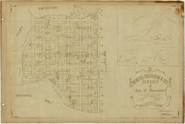
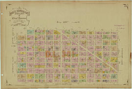
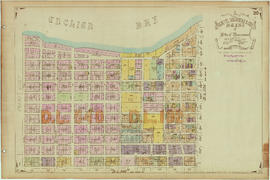
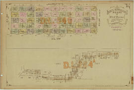
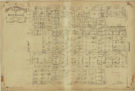
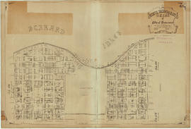
File is a property atlas, showing land subdivision in Vancouver, Point Grey, South Vancouver, Burnaby, New Westminster, part of Coquitlam, Richmond, and North Vancouver.
Notes area
Physical condition
Immediate source of acquisition
Arrangement
Atlas had previously been separated to the Map Collection; it has been returned to the collection that it was part of at the time of donation.
Language of material
Script of material
Location of originals
Availability of other formats
Restrictions on access
Terms governing use, reproduction, and publication
Finding aids
Associated materials
Accruals
General note
Location noted here is for cover only; see descriptions of individual sheets for sheet locations.
Alternative identifier(s)
Standard number area
Standard number
Access points
Subject access points
Place access points
Name access points
- Ricketts, Taschereau & Co. (Publisher)