Title and statement of responsibility area
Title proper
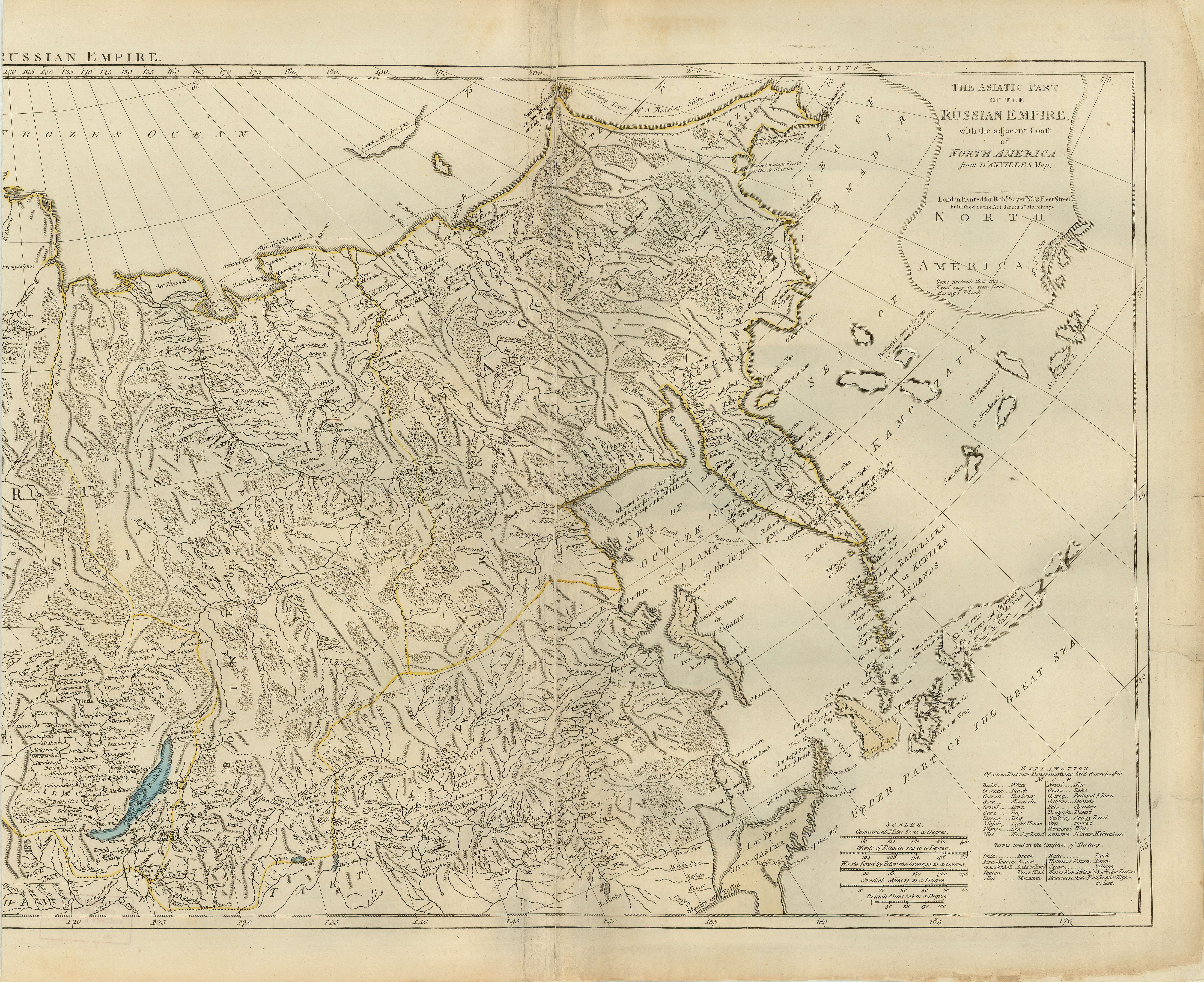
The asiatic part of the Russian empire
General material designation
- Cartographic material
Parallel title
Other title information
Title statements of responsibility
Title notes
- Continuation of title: … with the adjacent coast of North America from D'Anville's map
Level of description
Item
Reference code
AM1594-: MAP 856
Edition area
Edition statement
Edition statement of responsibility
Class of material specific details area
Statement of scale (cartographic)
Scale not determinable.
Statement of projection (cartographic)
Statement of coordinates (cartographic)
Statement of scale (architectural)
Issuing jurisdiction and denomination (philatelic)
Dates of creation area
Date(s)
-
Mar. 1772 (Creation)
Physical description area
Physical description
1 map : copper plate print, col. ; 55 x 67 cm
Publisher's series area
Title proper of publisher's series
Parallel titles of publisher's series
Other title information of publisher's series
Statement of responsibility relating to publisher's series
Numbering within publisher's series
Note on publisher's series
Archival description area
Custodial history
Scope and content
Item is a map sheet which appears to be a part of a map of Russia. The sheet depicts the area immediately around Lake Baikal, to the north coast and east to the Pacific, including the islands of the north-west Pacific.
Notes area
Physical condition
Left hand edge has been trimmed.
Immediate source of acquisition
Arrangement
Language of material
Script of material
Location of originals
Availability of other formats
Restrictions on access
Terms governing use, reproduction, and publication
Finding aids
Associated materials
Accruals
General note
Map formerly located at 519-D.
Physical description
Map appears to be only the left-hand portion of a larger map. Plate appears to have been removed from a book or atlas.
Rights
Public domain
Conservation
Sheet has been repaired and backed with paper.
External Link
ftp://webftp.vancouver.ca/archives/MAPS-TIFF/MAP856.tif
- Format: TIFF (LZW compressed)
- MD5: DEF66E574D0B1FAA591F39D191BF8093
- Size: 59801916 bytes